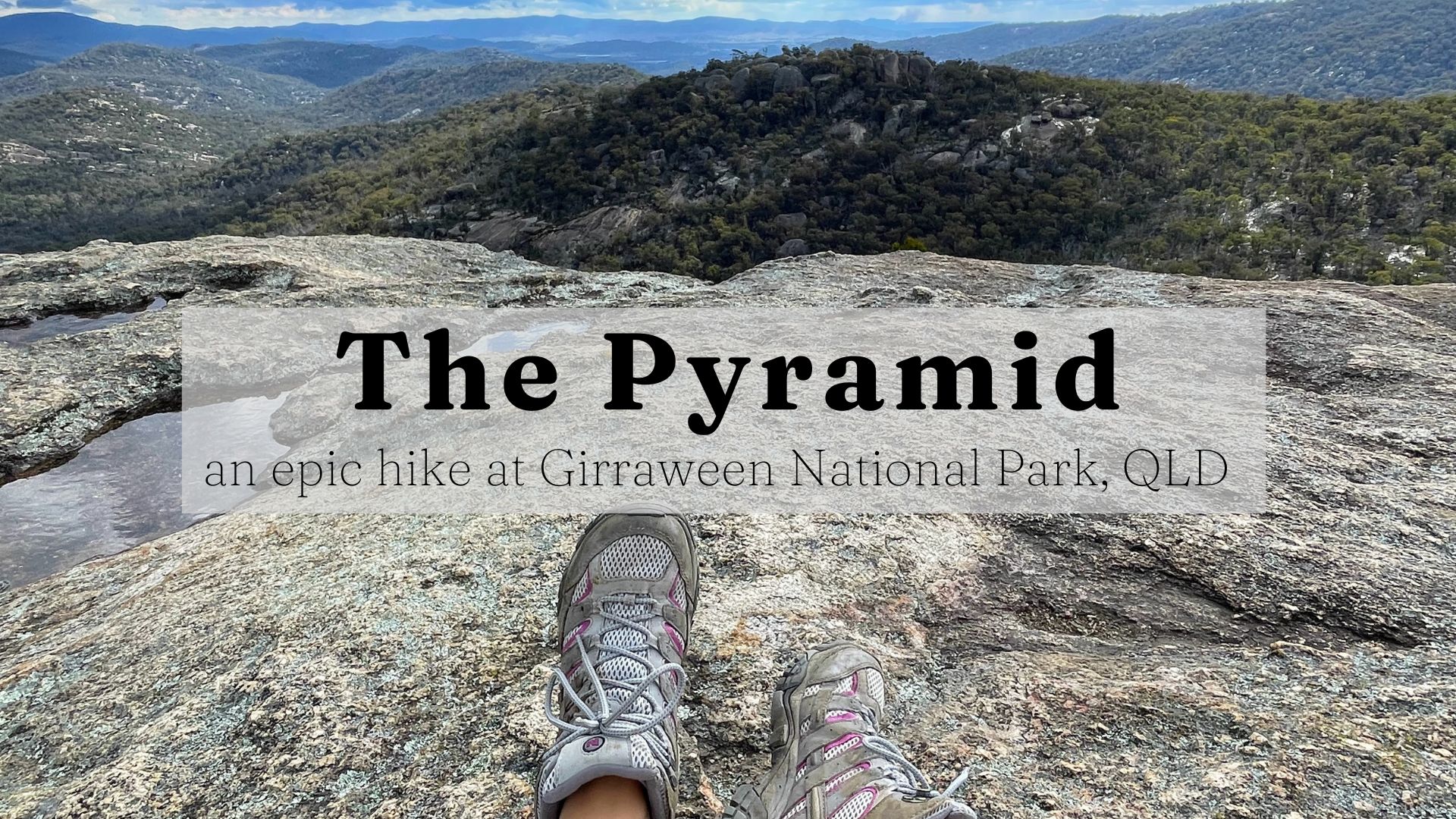
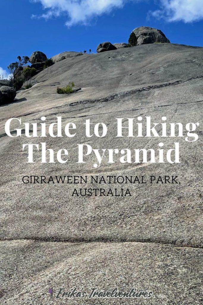
The Pyramid hike is located in Girraween National Park, just outside of Stanthorpe in southern Queensland. The Pyramid in Girraween is a unique hike that requires scrambling over a steep granite surface to reach the summit of the Pyramid monolith. The views from the top are breathtaking, from the Second Pyramid and Balancing Rock to one side, and the rest of the park’s famous granite structures on the other.
Although The Pyramid has some technically demanding sections and requires a good foothold, the hike is short and easily accessible. All of this is what makes the Pyramid one of the most popular hikes in Girraween National Park.
How to get to the Pyramid Hike in Girraween
Girraween National Park in Queensland is located a scenic 30-minute drive south of Stanthorpe town. Stanthorpe itself is located inland about two and a half hours southwest of Brisbane. A car is requested to reach Girraween, as there is no public transport option servicing the national park.
Girraween National Park is easy to navigate by car, with one large parking lot and a smaller one in front of the un-manned Visitor’s Information Center. A large grassy park with picnic tables, barbecue facilities, and restrooms can also be found here.
The two main groups of trails in the park, the Northern Walking Tracks and the Southern Walking Tracks, all leave from this general area. The Pyramid hike at Girraween is part of the Northern Walking Tracks section.
Key information about the Pyramid hike in Girraween
Here is some key information to help plan for your Pyramid hike at Girraween National Park near Stanthorpe:
Distance – 3.6 km
Duration – 1-2 hours
Difficulty – Moderate, with some scrambling required. Hiking experience required.
Things to know – Shoes with grip highly recommended, DO NOT hike in the rain due to slippery surfaces.
Note: Because the Pyramid isn’t a long hike, it can also be paired with a second hike at Girraween National Park, or with other activities back in Stanthorpe. Check out my 3-day Stanthorpe and Girraween itinerary to see how to fit the Pyramid Hike at Girraween into a Stanthorpe itinerary.
What to expect on the Pyramid trail
Starting the hike:
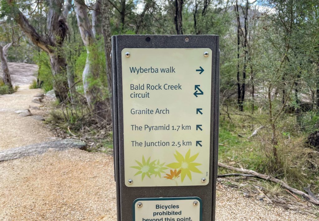
The trailhead of the Pyramid Hike is the same location as all of the other Northern Walking Track trails. A sign at the entrance shows a map of all the trails in the area, and another sign post lists the directions and distances of each hike.
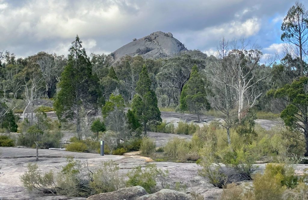
The Pyramid Hike trail starts along the Bald Rock Creek, where you can actually see the Pyramid monolith looming in the distance (it’s much bigger up close though). You’ll walk over some rock surfaces, then follow a wide gravel path towards the right. Eventually this path veers away from the rest of the easy Northern Walk Trails and starts to include up some rocky steps.
Note: Once you reach the Pyramid’s granite rock face, be sure to follow the trail marked by white stripes. This will ensure your safety, especially on the steeper sections.
Climbing up The Pyramid:
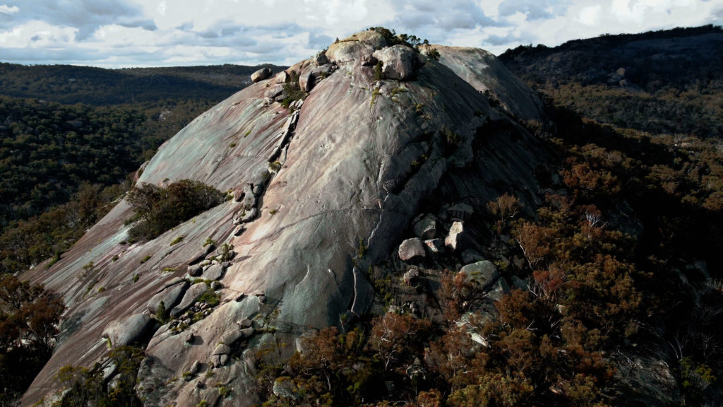
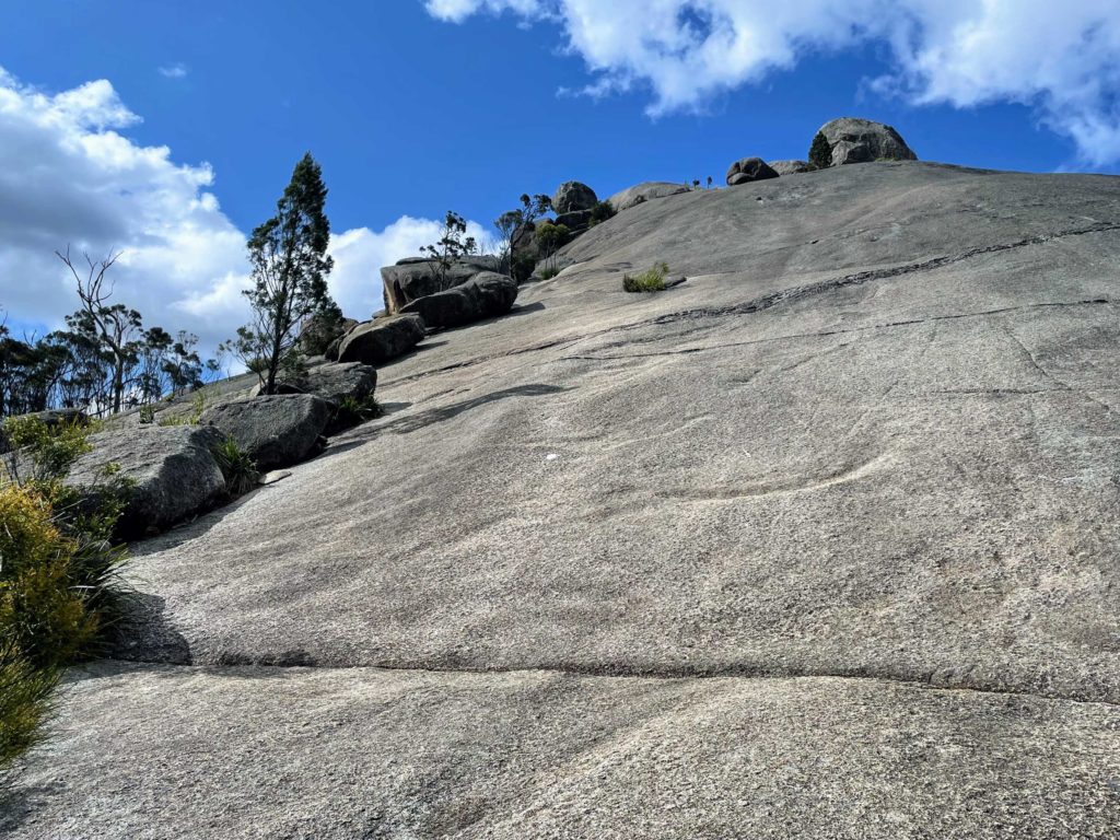
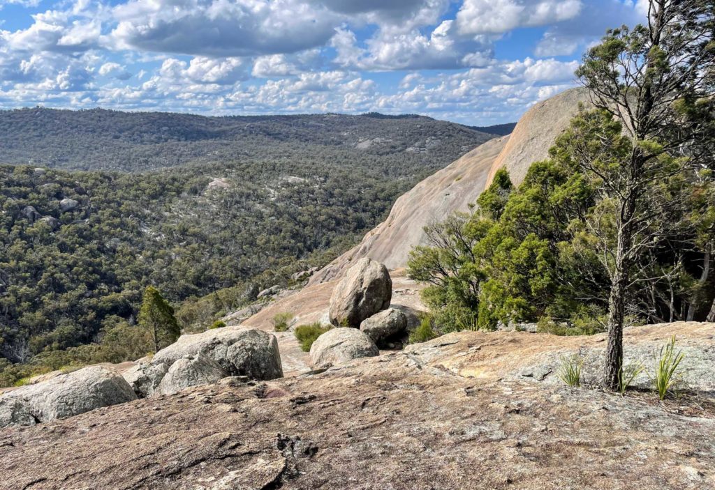
The Pyramid hike at Girraween gets very steep, very quickly. The trail follows a divot in the surface of the monolith, which runs from the base to about 3/4 of the way to the top (you can see a diagonal line in the image above). After a rocky section at the top of the divot, the trail cuts right across the slanted section to the left. This can evoke some serious vertigo in anyone scared of heights.
After that it’s back up an unbroken surface of granite. Some people who were hiking at the same time as us saw a carpet python (non-venomous) in this section, so keep your eyes peeled for critters like this.
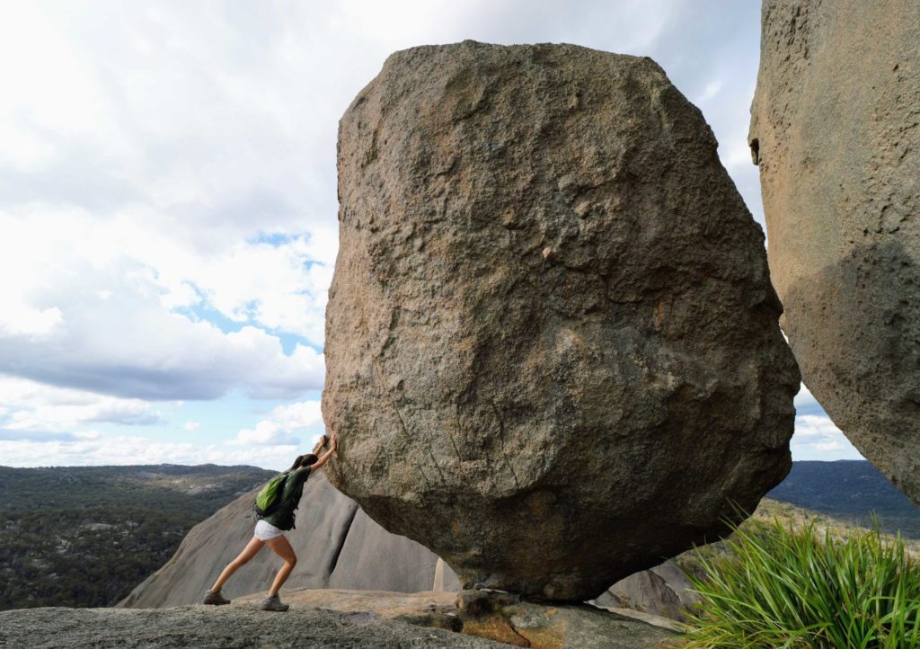
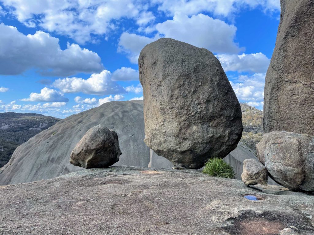
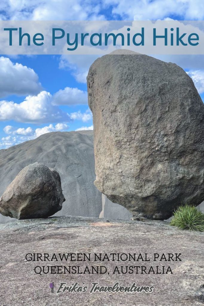
Just before the summit to the left is the iconic Balancing Rock, which is a favorite photo stop for visitors to Girraween National Park. I had to do it too 🙂
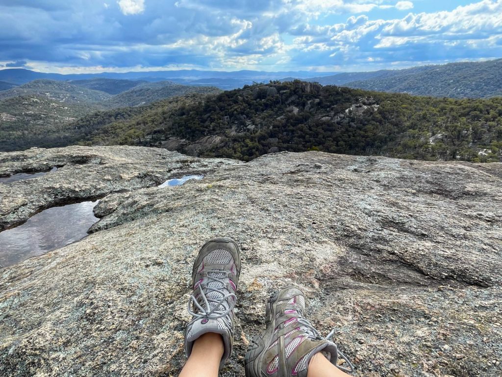
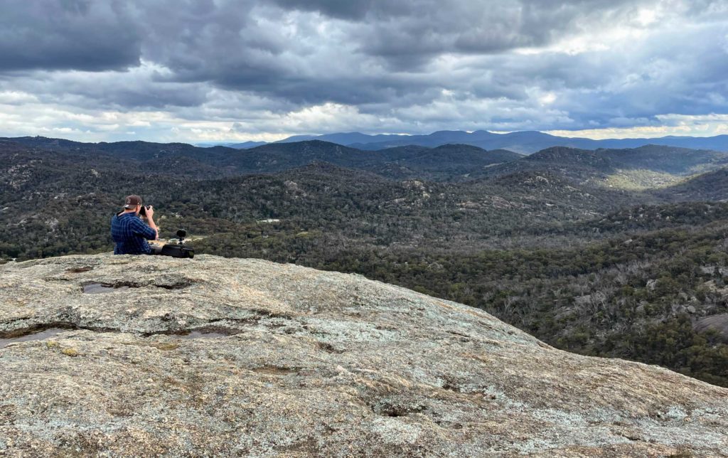
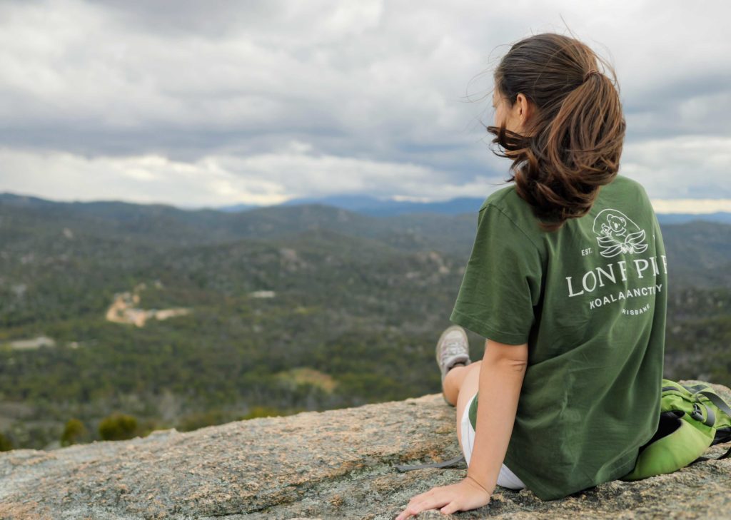
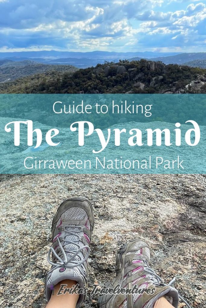
The summit of the Pyramid has a few trees and smaller boulders, as well as a wide open space for hikers to take in breathtaking 360-degree views.
From the summit you’ll see other famous Girraween National Park rock formations and landmarks like Castle Rock, Mount Norman, and Second Pyramid. You can even see the main parking lot and some campgrounds so you can be proud of how far up you’ve climbed!
Because it was very windy at the summit and we could see storm clouds coming in from the distance, we didn’t spend too much time at the top. Backtrack down the same trail to complete the epic Pyramid Hike at Girraween National Park.
The Pyramid Hike at Girraween - Summary
It took us about one hour to walk the length of the 3.6 kilometer (round-trip) Pyramid trail.
The trail is clearly marked and easy to follow, so there’s no concerns about getting lost. If you ever feel uncomfortable about the steepness of the climb, don’t feel bad about turning back. We ran into many people who turned back at the base of the Pyramid, or halfway to the top, due to its difficulty.
Tip: Keep in mind for anyone nervous about heights that it’s a lot more difficult to go down the Pyramid than it is to go up. While you’re mainly looking at the rock face while climbing up, on the way down you get to see the vastness of the forest below since the granite slopes out of your view. My palms are sweating just thinking about it! It’s totally acceptable to descend on your butt and all fours too.
Pyramid Hike Packing List
Noamenities are available once starting the Pyramid Hike at Girraween. Be sure to use the bathroom at the parking lot before starting the hike.
The National Park itself also doesn’t have any food or drinks available for purchase. When we visited, the Visitor’s Center was un-manned. Be sure to bring enough water from Stanthorpe town to stay hydrated, or purchase some food and drinks on the drive to Girraween National Park.
Water – bring at least 1 liter per person for this short hike.
Sunscreen – few sections on the Pyramid itself have any kind of coverage from the sun. Check out a reef-safe sunscreen option here, recommended in my Great Barrier Reef snorkeling post.
Snacks if you need them. Or just have some food in your car for when you return from the hike.
“Grippy” hiking shoes – Whether you’re in hiking boots or sneakers, you’ll need to have a lot of faith in the integrity of the rubber soles. I hiked in my trusty Merrell Moab boots which worked great.
Emergency toilet paper and trash bag – no toilet facilities are available along the Pyramid Hike at Girraween. The closest toilet facilities are located at the parking lot, so if you might have an emergency, take some emergency TP and a bag to carry out your waste!
Picnic mat – if you want to have a rest at the summit or at Bald Rock Creek, bring a picnic mat or something similar to sit on.
After the Pyramid hike - Granite Arch, Turtle Rock and the Sphinx, or Castle Rock
Because most of the trails at Girraween National Park start from the same place, you don’t even need to move your car to start another hike!
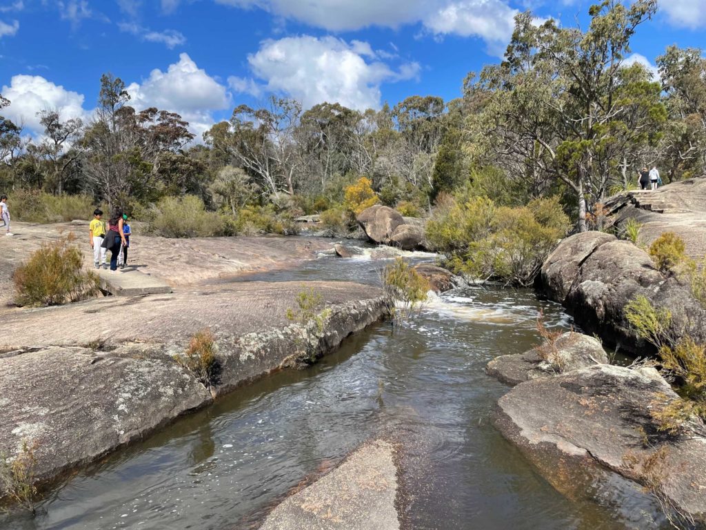
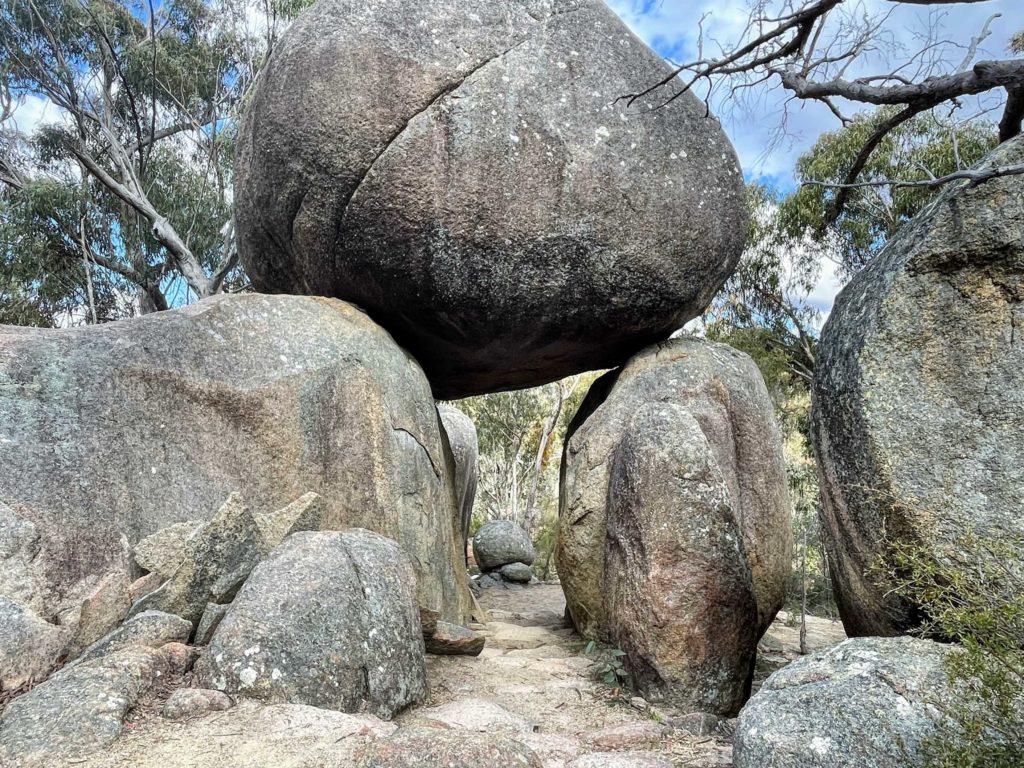
After conquering the Pyramid, consider exploring more leisurely walks among the Northern Walking Trails like the Bald Rock Creek Circuit. One unmissable stop is to the Granite Arch, a visitor’s favorite and perfect photo opp. To complete all of the Northern Walking Trails (8.3 km), budget about 4 hours. If you brought a swimsuit and towel, you can also spend time at Bald Rock Creek’s many rockpools and natural slides.
We decided to hike one of the Southern Walking Trails, to the Sphinx and Turtle Rock formations. My hiking guide to the Sphinx and Turtle Rock hike can be found here.
Another popular option among the Southern Walking Trails for the view of the National Park is to Castle Rock, another granite monolith to summit.
Granite Arch
A view of the Sphinx from Turtle Rock
Where to stay in Girraween National Park
The only option to stay in Girraween National Park is camping, either in a trailer or tent. Camping spots are limited so reservations must be made in advance through the Queensland National Parks website.
The closest accommodation option to Girraween National Park is the beautiful Girraween Environmental Lodge. This highly sought-after accommodation puts visitors at the doorstep of the park, in beautiful chalets located in the heart of the Australian bush.
For recommendations on where to stay in Stanthorpe, check out my Stanthorpe Itinerary here.