Long distance hiking is one of the best ways to see new places and experience new countries. I especially love multi-day hikes because they require getting off-the-beaten-path, spending time in nature, and often include visiting small and remote villages. Although I’ve completed a number of day-hikes in Japan, I wanted to explore my options for epic multi-day hikes in Japan too. Below, I’ve compiled a list of 13 best multi-day hikes in Japan, perfect for anyone’s Japan hiking bucket list!
Most multi-day hikes in Japan are not more than a day away from roads and transportation options. If you don’t have time to complete the full long distance hike, opt to spend a few days on the trail then catch a train back to the city.
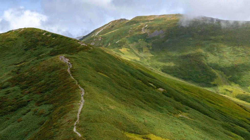
Multi-day or long distance hiking in Japan
Many of these multi-day hikes in Japan started off (and are still used) as pilgrimage routes. For hundreds of years, pilgrims from various Buddhist and Shinto sects have spent days and weeks following mountainous and forested trails to visit a string of remote temples and shrines.
Some of these multi-day hikes in Japan were also old trade and transport routes that connected major cities. Much has changed since Japan’s Edo era and some sections of the trails have turned into bustling urban centers, but some mountain villages still retain their old-world traditions, culture, and charm.
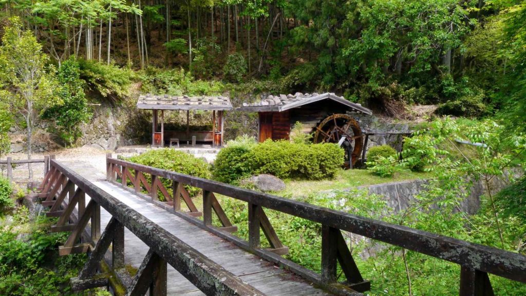
1. Kumano Kodo
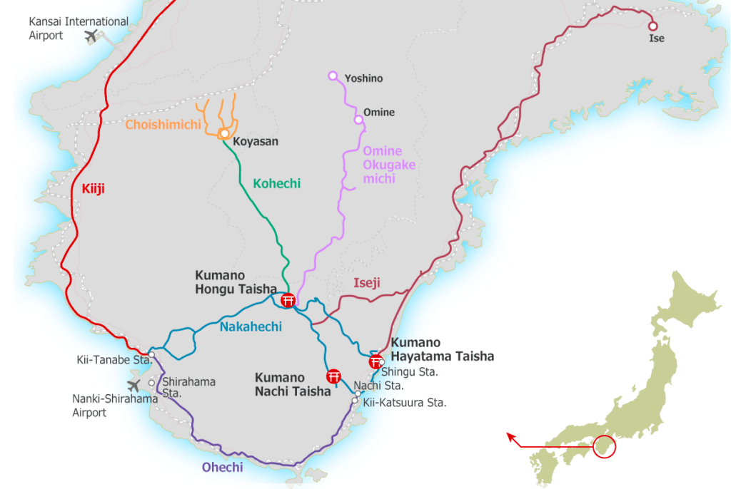
The Kumando Kodo is one of the most famous multi-day hikes in Japan located on the Kii Peninsula south of Osaka. For over a thousand years, this network of trails has been used as a Buddhist pilgrimage route, brining together people from all walks of life. The Kumano Kodo trails span from Ise town in the northeast to the famous Koyasan, to Kushimoto in the south and Kii-Tanabe in the west.
In 2004, the Kumano Kodo was registered as a UNESCO World Heritage pilgrimage route, and it has been compared to Spain’s famous World Heritage pilgrimage route: the Camino de Santiago. Read more about the heritage status of the Kumano Kodo the UNESCO website.
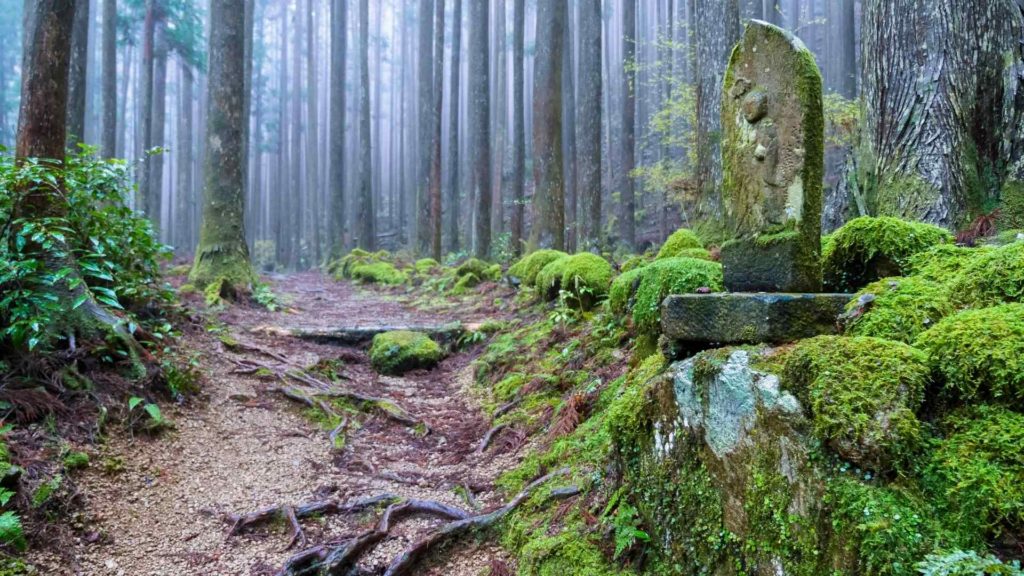
A number of different trails make up the Kumano Kodo, which vary in scenery, duration, and difficulty (see detailed maps on their website here). The Iseji and Ohechi trails are more coastal for example, and the Kohechi and Omine trails further inland lead to auspicious Japanese mountains like Mount Koya and Mount Omine. The most popular trail, and the trail most people refer to when they talk about the Kumano Kodo, is the Nakahechi trail.
The Nakahechi trail runs west to east and starts in Takijiri (also home to the Kumano Kodo information Center). Popular towns to stay in along the route are Takahara, Chikatsuyu, Fushiogami, Kumano Hongu Taisha or Yumonime Onsen, Koguchi, and finally ending in Seiganto.
Here’s some additional information about the multi-day Nakahechi trail on the Kumano Kodo in Japan:
- Duration: 5-6 days, 5-8 hours of hiking per day
- Distance: ~70 km
- Accommodation: Guesthouses, camping optional, reserve ahead of time at the Kumano Travel website.
- Food: Provided at guesthouses, some restaurants along the way. Can be purchased before starting and carried, prepared at guesthouses too.
- Location: Kii Peninsula, Wakayama Prefecture, Kansai region of Honshu.
- Closest large city: Wakayama, Osaka
- Other things to know: The Kumano Kodo is one of the best multi-day pilgrimage hikes in terms of amenities and organization in Japan. Facilities for trekkers including luggage transfers and tours are available as well as various maps and pamphlets. Visit the Kumano Kodo tourist information center before starting to learn more.
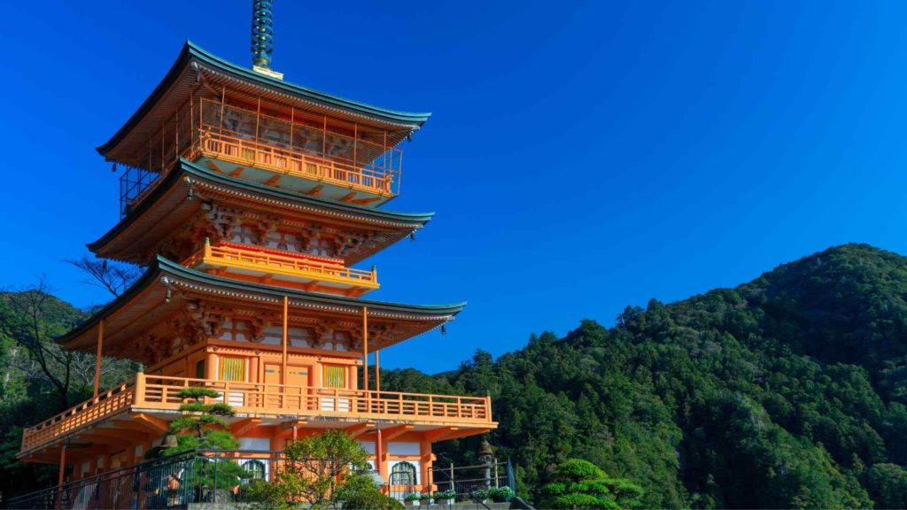
2. Nakasendo (Kiso Valley)
The Nakasendo was a historic highway that connected two major cities of Edo (Tokyo) and Kyoto. The 540-kilometer trail was constructed in the 7th century, crosses mountains and rivers, and is made up of 69 “station towns” where travelers stayed the night along the journey. For its scenery, history and preserved culture, the Nakasendo is undoubtedly one of the best multi-day hikes in Japan.
The original Nakasendo route ran from Kyoto to Gifu, through Nagano prefecture up to Karuizawa, then down through Saitama prefecture to Tokyo. If you want to walk the whole 540km distance in one epic, multi-day hike in Japan – be my guest, and let me know how it goes! Many sections have transformed from small station towns to urban centers though, and have fallen away as popular hiking destinations as a result.
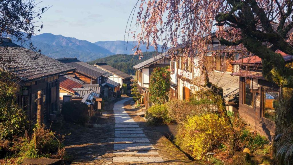
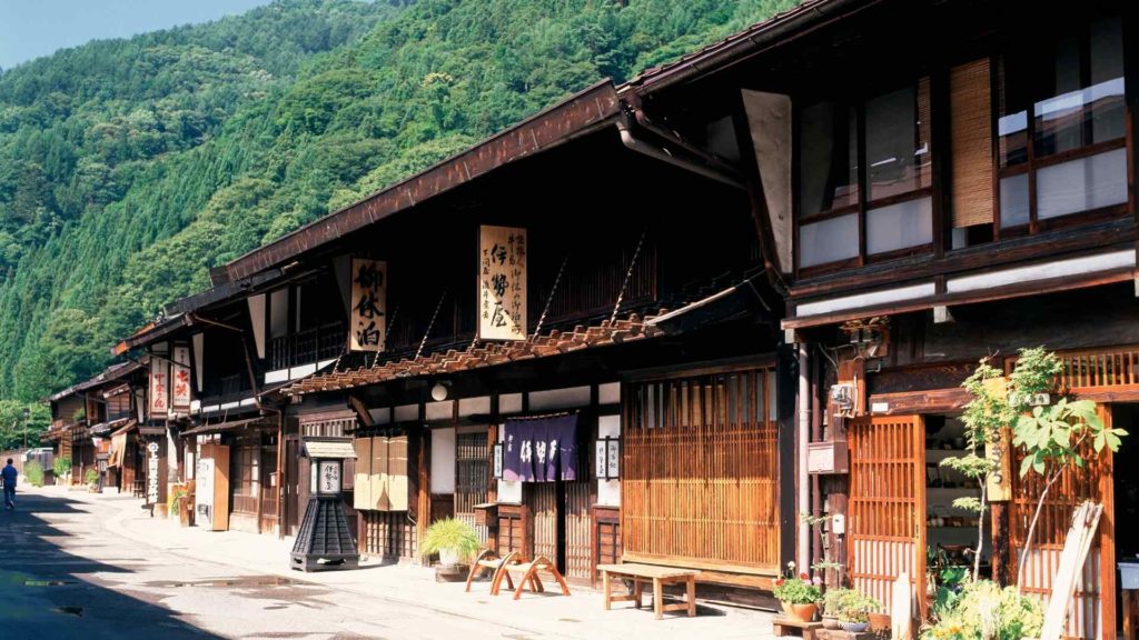
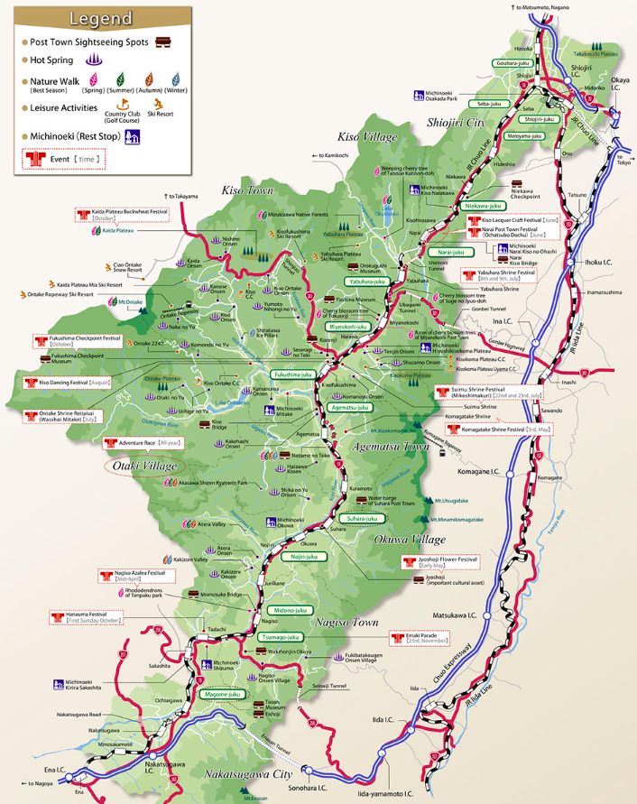
The most popular section of the Nakasendo route today, and one that has worked hard to preserve its old-world look and culture, is the Kiso Valley section. This multi-day hike through the Kiso Valley spans from Nakatsugawa town in the south (northeast of Nagoya) to Hideoshio in the north. It connects former Nakasendo station towns including Magome, Tsumago, Nojiri, Agematsu, Kiso-Fukushima, Narai, and Hideshio (with many more small villages in between).
Many of these villages have worked to preserve the atmosphere of Edo-era Japan, such as my retaining the same building facades along the Nakasendo pedestrian road and keeping all modern amenities (such as electricity transmission lines) out of sight. Travelers can stay in old-fashioned guesthouses and onsen hotels along this traditional multi-day hike in Japan.
Here’s some additional information about the Nakasendeo, one of the best multi-day hikes in Japan:
- Duration: 6-7 days, 4-8 hours of hiking per day
- Distance: ~90 km
- Accommodation: Guesthouses, reserve ahead of time.
- Food: Provided at guesthouses, some restaurants along the way.
- Location: Kiso Valley, Nagano Prefecture, on Honshu.
- Closest large city: Matsumoto, Nagoya
- Other things to know: The most popular towns to visit in the Kiso Valley on the Nakasendo trail are Magome and Tsumago. Many Kiso Valley hiking tours run just between these two towns, then drive or train up to Kiso-Fukishima or Narai for a 2-3 day excursion in total.
3. Kamikochi
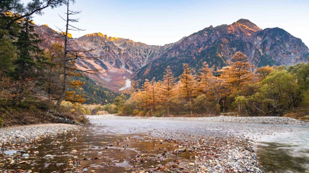
No list of multi-day hikes in Japan is complete without including the Kamikochi mountains, also known as the Japanese Alps. This remote hike takes you along mountain ridgelines (and to the rocky summits if you’re brave), and includes some of the most beautiful landscapes of Japan.
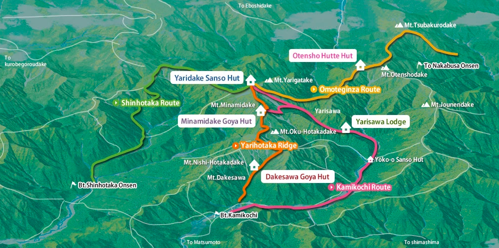
Because there are a number of trails that intertwine, you’re able to DIY your own preferred multi-day hike in this area. Most trails start at Kamikochi tourist village, which is situated along the Azusa River and is home to many mountain lodge accommodation options. At 1500m above sea level, it’s the gateway to the Japanese Alps.
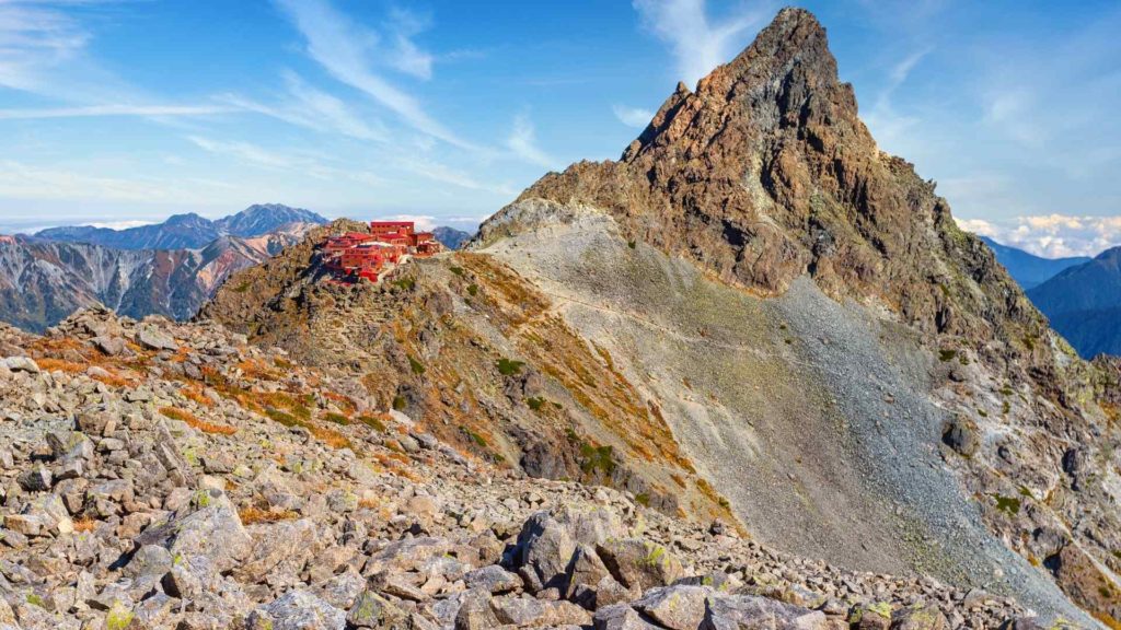
Here are some sample itineraries for a 4-day, 3-night circuit hike in Kamikochi. I’ve listed the mountain summits or other landmarks as overnight stay locations. Each have huts, lodges, and/or campgrounds nearby where hikers can book their stay. Check out some maps and additional multi-day hiking itineraries here.
- Kamikochi – Mount Hokata – Mount Yari – Mount Otensho – Nakabusa trail head (one-way)
- Kamikochi – Yoko’o Bridge – Mount Yari – Mount Hokata – Kamikochi (circuit)
- Kamikochi – Mount Chogatake – Mount Otensho – Mount Yari – Kamikochi or Yoko’o Bridge (circuit)
Be prepared for difficult ascends and decents, as well as trails that require some scrambling. To actually summit the mountains is optional because they are side-treks. This requires technical skill and previous experience. Weather is also an important factor to take into account when hiking these high-altitude mountains.
Read more safety tips on the Kamikochi website here.
*Nagano prefecture requires submitting a trekking itinerary before embarking on some of the more challenging mountain hikes.
Here’s some more information about the best multi-day hikes through the Japanese alps below:
- Duration: 1-4 days
- Distance: 20-40 km
- Accommodation: Mountain huts or camping, reserve ahead of time.
- Food: Purchased at mountain huts
- Location: Kamikochi, Nagano prefecture on Honshu
- Closest large city: Matsumoto, Takayama
- Other things to know: It’s worth spending a day or two in Kamikochi village before or after the multi-day hike, admiring the mountain and river views, as well as acclimatizing to the altitude. A number of short and scenic walks are popular here.
4. Shikoku 88 Temple Pilgrimage (Shikoku Henro)
The Shikoku 88 Temple Trail is of the longest multi-day hikes in Japan if all 88 temples are visited consecutively. Also known as the Shikoku 88 or Shikoku Henro, the trail follows the footsteps of the Buddhist priest Kukai, who is believed to have trained at the Shikoku temples around the 9th century (he’s also credited with establishing Mount Koya as a sacred Buddhist site, south of Osaka). The pilgrimage trail as it stands now was established between the 16th and 17th century, however formal documentation of this pilgrimage trail date back to the 12th century.
This pilgrimage trail is more than 1,200 km in length and circles much of Japan’s smallest Shikoku island, including all four prefectures. Many sections of the trail are well-connected by public transit, so most hikers and pilgrims choose to undertake the Shikoku 88 temple trail across multiple separate trips.
The Shikoku Henro pilgrimage trail starts in Tokushima prefecture at Ryozenji Temple (Temple 1). The end of the trail is Okuboji temple in Kagawa prefecture (Temple 88). A number of other sacred sites and relics can also be visited along this pilgrimage hike.
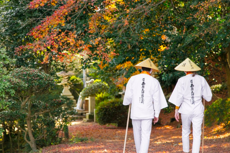
The Shikoku official tourism website recommends that pilgrims embarking on this trail wear a white vest and carry a wooden staff, so others are aware that you are a pilgrim on the Shikoku Henro. Local people and business in the region will often recognize, welcome, and assist pilgrims who are on their spiritual journey. Pilgrims often collect temple stamps at each temple location as well, in a temple pass book.
Be sure to review proper temple etiquette for visiting temples in Japan.
Here’s some additional information about the Shikoku 88 Temple Pilgrimage trail in Japan:
- Duration: 6-8 weeks
- Distance: 1200 km
- Accommodation: Guesthouses. Some homes along the trail offer overnight accommodation to pilgrims for free.
- Food: Available at guesthouses, convenience stores, restaurants and cafes in urban centers along the trail.
- Location: Shikoku island
- Closest large city: Takamatsu, Matsuyama, Kochi
- Other things to know: The path markers for this multi-day hike in Japan are easiest to follow when hiking clockwise, starting at Temple 1.
5. Daisetsuzan Grand Traverse
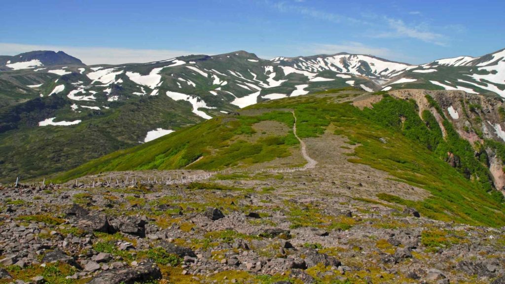
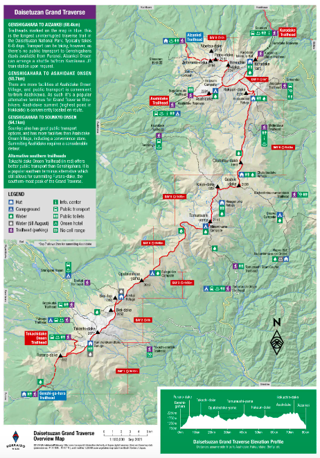
The Daisetsuzan Grand Traverse is the most challenging and remote hike on this list of multi-day hikes in Japan. It’s located on the northern island of Hokkaido in Daisetsuzan National Park, the largest national park in Japan.
The trail spans the tops of the Daisetsuzan Mountain Range and retains an altitude of 2,000 meters above sea level for the whole trek. Bring your own tents, sleeping bags, food, and even carry out your own waste in some sections of this hike. Hokkaido’s alpine and volcanic terrain paired with potentially dangerous weather makes this hike one hell of an adventure.
Japanese mountaineers and skiers have been tacking this trail to prove endurance and skill for over 100 years.
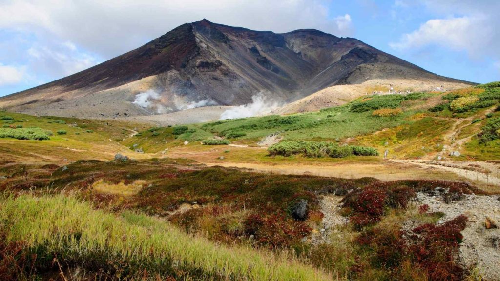
Embarking on this remote hike requires a bit of planning in advance. The Daisetsuzan Grand Traverse is a through-hike, not a circuit, so hikers need to arrange transportation to and from the hike. The trail starts at Mt. Furanodake in the south and ends at Mt. Asahidake in the north. A number of bare campsites and un-manned refuge huts mark where hikers stay the night.
If you’re not interested in embarking on the full 8-day hike, consider the 3-4 day Southern and Northern Traverse options which branch off from the Grand Traverse.
Here’s some additional information about the multi-day Daisetsuzan Grand Traverse in Hokkaido, Japan:
- Duration: 7-8 days, 5-8 hours of hiking per day
- Distance: ~80 km
- Accommodation: Camping and mountain refuge huts with no amenities
- Food: Carry in and carry out
- Location: Daisetsuzan National Park, Hokkaido
- Closest large city: Sapporo
- Other things to know: The absolute best resource for this challenging multi-day hike in Japan is Hokkaido Wilds guide to the Daisetsuzan trail.
Heading to Hokkaido? Check out my list of Hokkaido ryokan with private onsen. Your body will thank you for relaxing in a private in-room hot spring after embarking on one of Japan’s best multi-day hikes!
6. Mt. Fuji Summit
Summiting Mt. Fuji is also a bucket-list multi-day hike in Japan. Fuji-san as it’s referred to by the locals is the tallest mountain in Japan at an impressive 3,776m above sea level. It’s also a sacred location in the Shinto religion. The mountain has been designated a UNESCO World Cultural Heritage site for being a sacred place and source of artistic inspiration.
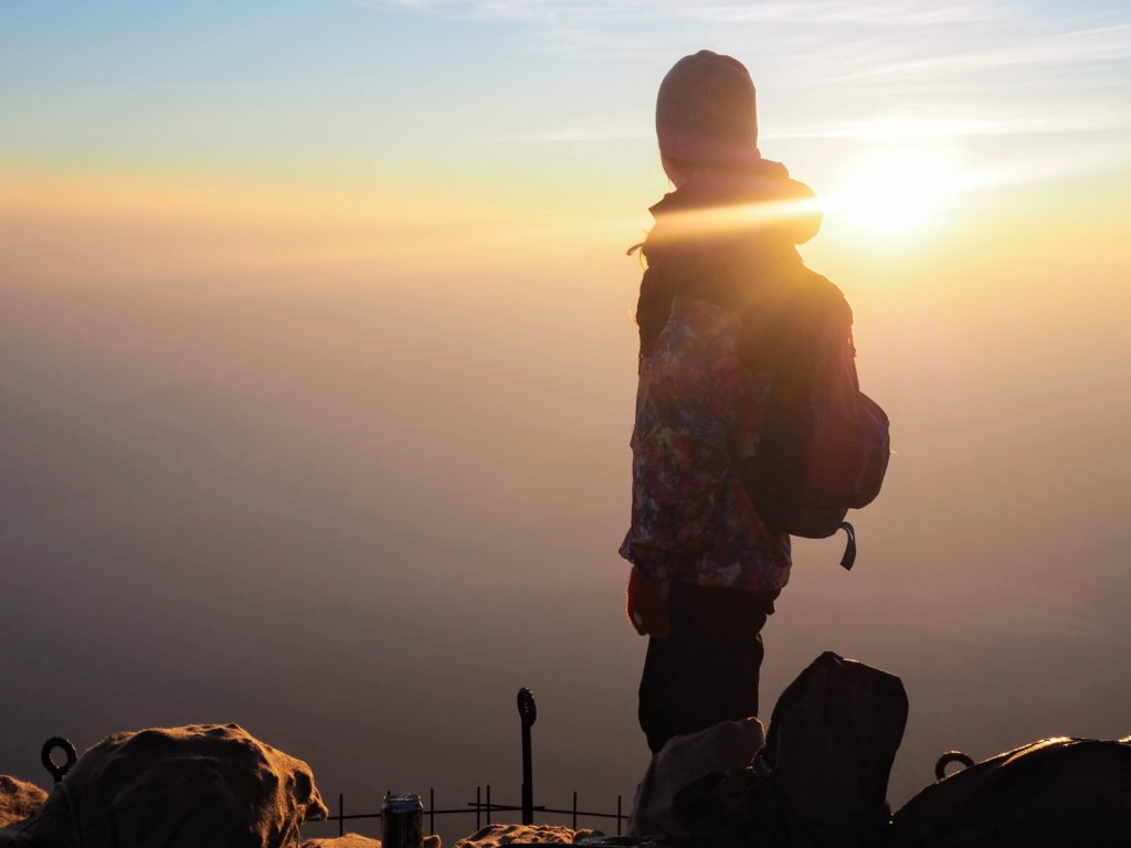
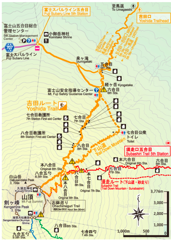
Many visitors to Japan seek to summit Mt. Fuji, and it is one of the most popular multi-day hikes for both tourists and locals. Hikers usually take two days to reach the summit by starting at the Mt. Fuji 5th station in the middle of the day, staying in a mountain hut overnight, then beginning the summit hike just before sunrise the next day.
I wrote in this blog post about my bullet-hike to summit Mt. Fuji, which meant arriving at Mt. Fuji’s 5th Station at around 10pm in the evening and starting the summit climb through the night. I reached the top long before sunrise and was back in Tokyo in time for brunch!
Neither the bullet hike nor the 2-day Mt. Fuji summit hike start at the base of the mountain though. The 5th station is actually over 60% of the way up the mountain.
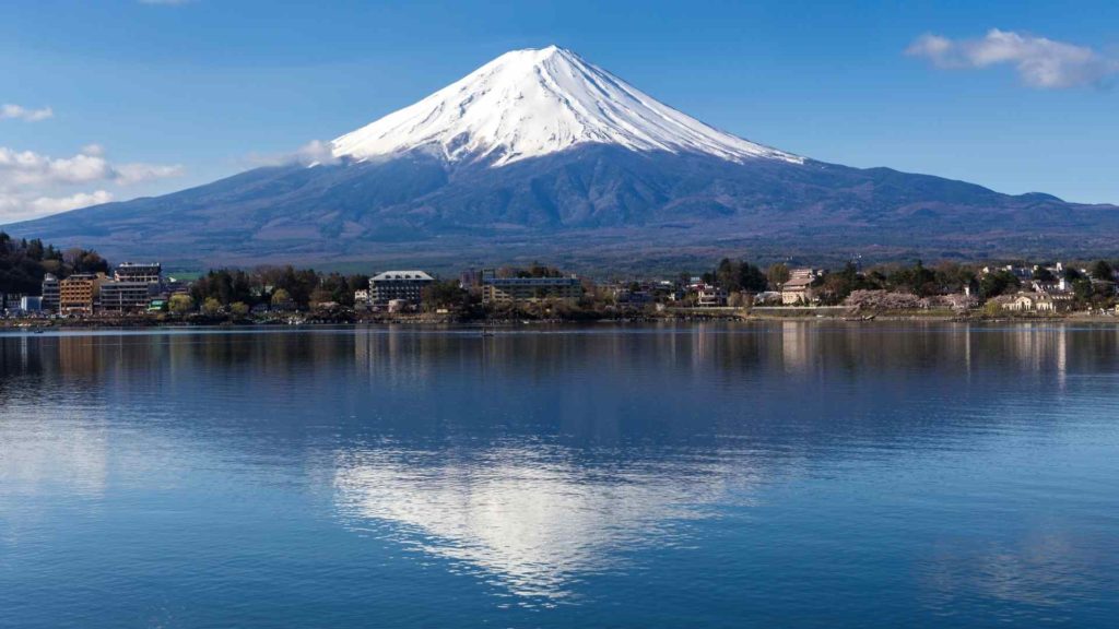
Hikers have an option to extend the Mt. Fuji multi-day hike in Japan, and start their hike from the base of Mt. Fuji (Station 0). The trails that connect the1st-4th stations up to the 5th stations of Fuji-san still exist today, and are maintained as local walking trails and pilgrimage routes. Each of the four 5th stations operating on Mt. Fuji (Yoshida, Subashiri, Gotemba, and Fujinomiya), have trails that connect to them from the lower slopes of Mt. Fuji, and a town at the base. This extends the Mt. Fuji hike from a typical 4-km summit push to a 20 km uphill battle.
One example is the Yoshia-Guchi climbing trail, which starts at the Fuji Sengen Shrine.
If starting the Mt. Fuji summit hike below 5th station, it’s recommended to break up the hike into two days by staying at the 5th station or at a mountain hut higher up.
Here’s some additional information about the multi-day Mt. Fuji hike in Japan:
- Duration: 1-2 days
- Distance: 4-20+ km
- Accommodation: Mountain huts above the 5th station, or a hotel at the 5th station for longer hikes
- Food: Provided at mountain huts, at the summit, some restaurants at the 5th station.
- Location: Kanto region
- Closest large city: Tokyo
- Other things to know: Mt. Fuji is well-serviced along the trail and at the summit by guesthouses and shops. Bring 100 yen coins to use the restrooms, and coins for the vending machines at the summit that have both cold and hot drink options.
For hikers wanting to add even more distance to an epic multi-day hike in Japan, a “Sea to Summit” pilgrimage of Mt. Fuji is also possible.
Always check the official website for climbing Mt. Fuji for the latest news, before attempting.
7. Okinawa North to South Traverse
Visiting Okinawa for to live the island life and enjoy some beach time? Consider adding the Okinawa North to South Traverse, an epic multi-day hike in Japan, to your list! Okinawa is an island off the coast of southern Japan, famous for its tropical climate, marine life, and having its own unique traditions and culture.
Okinawa is also home to a U.S. army base and the associated Okinawa USO, the United Service Organization, a non-profit which provides support, organizes activities and entertainment, and more for US armed forces members and their families in Okinawa. In the past, the USO has organized a group in-person walk, hike, or run of the length of Okinawa from north to south, broken up into three massive 30km days.
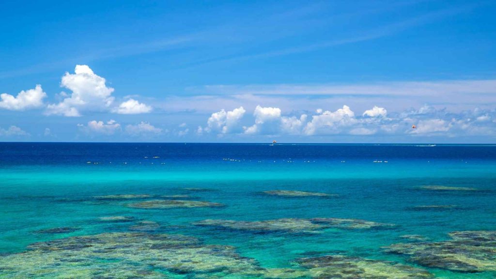
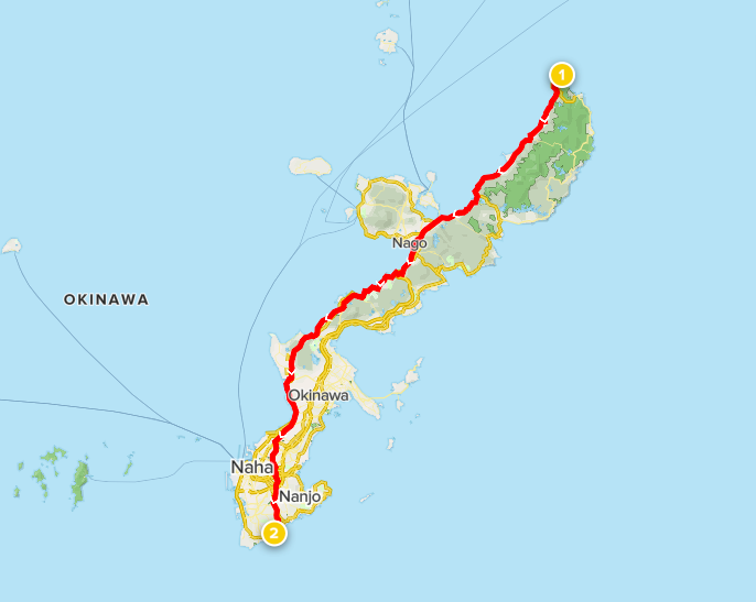
This multi-day hike in Japan isn’t a nature hike per say, and follows busy roads in some sections, but it’s surely a great bucket-list activity. The hike starts in the north at Cape Hedo and ends at the Peace Memorial Park in the south. Suggested overnight stays include Nago and Chatan (both towns along Route 58). Since the bottom third of the island is the most densely populated, you’ll have no trouble finding accommodation or places to eat in town.
After completing this, you’ll be one of few people who can say you’ve walked the whole length of Okinawa island on an epic multi-day hike in Japan!
Here’s some more information about the multi-day hike in Okinawa, Japan:
- Duration: 3-4 days, 7-8 hours of hiking per day
- Distance: ~110 km
- Accommodation: Guesthouses, hostels, hotels. Reserve ahead of time or see how far you get each day and stay somewhere nearby.
- Food: Restaurants, convenience stores and cafes plentiful
- Location: Okinawa island
- Closest large city: Naha
8. Kanto Fureai no Michi
The Kanto Fureai no Michi is a multi-day hike in Japan that’s easily accessible from Tokyo. In fact, one of the most popular day-hikes from Tokyo, Mt. Takao, is included in two separate sections of this long distance hike.
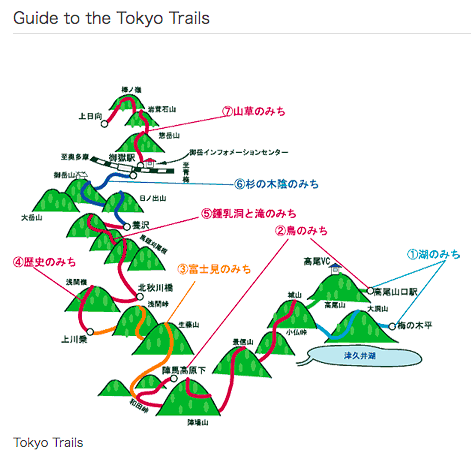
Fureai no Michi translates to “friendship trail”, and is also called the Greater Tokyo Area Nature Trail. Each section of the trail is a distance 8-20 km long that can be undertaken as day-hikes, or strung together with overnight accommodation to become a village-to-village long distance hike.
The Tokyo section of the Fureai no Michi is made up of 7 sections, so will take a week to complete. Because the start and end of most sections are accessible by public transit, many hikers choose to do 1-2 sections at a time on weekends away from Tokyo.
The first section, nicknamed the Lake Trail is 16.2 km long and takes about 7 hours to complete. The trail starts at Umenokidaira Bus Stop near Machida town west of Tokyo, circles around to the Misawa and Kobotoke Passes, then over Mt. Takao to finish at Takaosanguchi Station.
See detailed maps and descriptions of all Tokyo sections here.
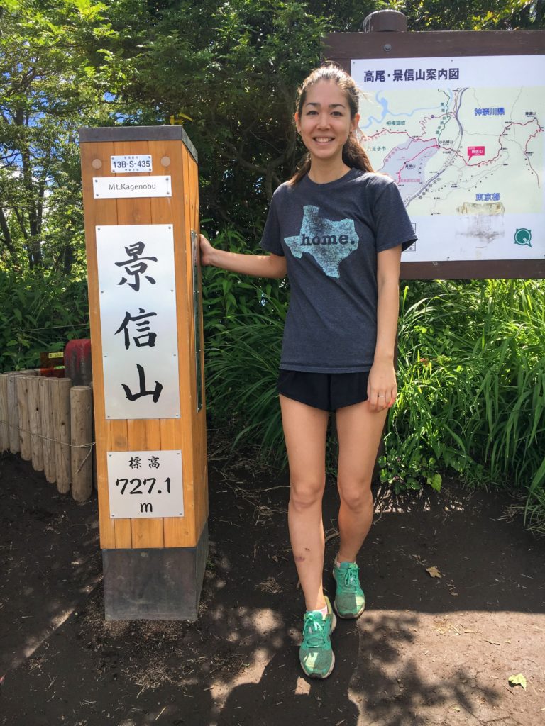
Hikers can work towards getting a Kanto Fureai no Michi completion certificate from the Tokyo Natural Parks office by submitting photos at designated checkpoints along each section of the trail. The photo above is me at Mount Kagenobu, the checkpoint for the Fureai no Michi trail section between Mt. Jinba and Mt. Takao, also nicknamed “The Bird Trail”.
Checkpoints are listed on the official website of the Fureai No Michi.
If the Kanto long-distance hike section isn’t enough for you, there are also Fureai No Michi trails across five other prefectures as well: Gunma, Saitama, Kanagawa, Tochigi, and Chiba. You can collect completion certificates from all six prefectures, submit a photo of them to the Natural Parks office, and be one of very few people in Japan to receive an honorary badge to show completion of all 160 sections. Now that’s something to boast about!
Check out detailed maps of each section of this long distance hike here.
Here’s some additional information about the multi-day Kanto Fureai no Michi hike in Japan:
- Duration: 7 days for the Tokyo sections
- Distance: 74.4 km of trails in the Tokyo sections, 1799 km in total across six prefectures
- Accommodation: Guesthouses, ryokan, mountain huts at some summits.
- Food: Provided at guesthouses, some small cafes along the way.
- Location: Kanto region
- Closest large city: Tokyo
- Other things to know: Take photos at designated checkpoints along the way if you want to get a completion certificate at the end!
9. Basho Wayfarer's Journey
The Basho Wayfarer’s Journey is a multi-day hike in Japan that follows in the footsteps of a Japanese haiku master, Matsuo Basho, who lived in the 17th century. His haiku poem travelogue, Narrow Road to the Deep North*, is a piece of classic Japanese literature that outlines his experience walking across the countryside of Japan. The route he took to gain inspiration for this poetry is now known as the Basho Trail.
*Depending on the translation, “Deep North” is sometimes replaced with “Interior” or “Hinterland”. Check out the book on Amazon here and read more about his journey here.
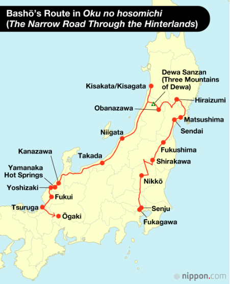
The full trail is a whopping 2,500 km that Basho walked over six months. He started in Tokyo and walked inland past Nikko to as far north as Matsushima and Hiraizumi in Sendai, then back down along the western coast to Kanazawa, and ended in Ogaki in the Gifu Prefecture.
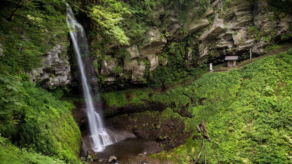
Key sights and landmarks along this long-distance trail are mentioned in Basho’s haiku travelogue. These include Uramino-taki waterfall near Nikko (below), the Three Mountains of Dewa in Yamagata prefecture, and the Akakura Onsen area also in Yamagata.
Hikers who want to follow in Basho’s footsteps but not spend six months on the trail can consider taking on the northernmost section where many of the most famous landmarks are. Start in the town of Matsushima, hike up to Hiraizumi, then cut across (while stopping in onsen towns) to reach the Three Mountains of Dewa.
Here are some other things to know about the Basho Trail:
- Duration: Up to 6 months
- Distance: Up to 2,500 km
- Accommodation: Guesthouses, ryokan, hotels in urban centers
- Food: Available at guesthouses, convenience stores, restaurants and cafes in urban centers along the trail
- Location: Honshu island, including Gifu, Sendai, Yamagata, and Kanto prefectures.
- Closest large city: Start in Tokyo, passes through Sendai and Kanazawa
- Other things to know: Read up on Basho’s haikus in his travelogue before you embark on this hike.
10. Michinoku Coastal Trail
Many of us may remember in 2011 when a massive earthquake and following tsunami devasted the northeastern Tohoku region of Japan. Most famously, this natural disaster caused nuclear meltdowns at the Fukushima Daiichi Nuclear Power Plant. It also devastated countless small towns and uprooted the lives of millions along this coastline.
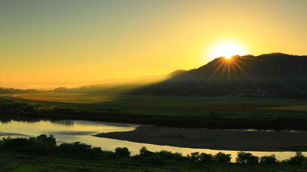
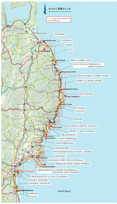
This Michinoku Coastal Trail was established in 2019 in order to reinvigorate tourism to this area, and showcase the beautiful coastal and mountainous landscapes here. The long distance trail in Japan that spans from Hachinohe City in Aomori Prefecture all the way to Soma City in Fukushima Prefecture.
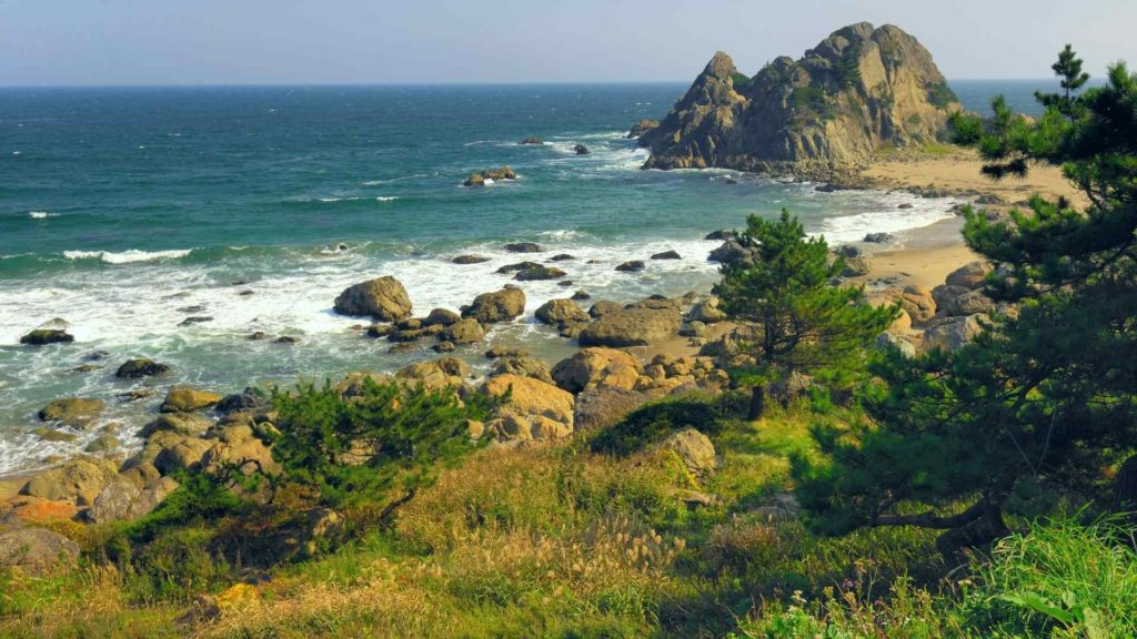
The trail is about 1000 km long it its entirety, but has been broken down into 28 smaller sections, each 1-2 days long.
See all the sections and associated maps on the official website here.
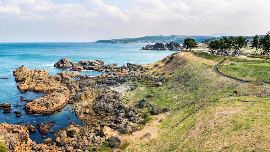
Different sections of the trail offer different experiences and vantages along the Tohoku coastline. For example if you’re interested in rugged coastlines, rocky shores and and steep cliffs, check out Iwate prefecture sections of the trail. For rural scenery, hot springs, and wildlife, check out the Miyagi prefecture sections of the trail.
Here are some other things to know about the Michinoku Coastal trail in Japan:
- Duration: ~50 days
- Distance: ~1000 km
- Accommodation: Hotels, guesthouses, and camping available. A map of accommodation options is available here.
- Food: Available at guesthouses, some convenience stores, restaurants and cafes in towns along the trail
- Location: Tohoku
- Closest large city: Sendai, Fukushima
11. Chichibu 34 Kannon Pilgrimage
The Chichibu 34 Kannon Pilgrimage is a long distance hike in Japan located in Saitama, the prefecture northwest of Tokyo. The pilgrimage connects 34 temples in the region that are dedicated to Kannon, the Buddhist goddess of mercy and compassion. This long-distance hike in Japan dates back to the 13th century and was popular during the Edo era as a pilgrimage trail as well.
The most detailed route for visiting all 34 temples in the Saitama area is this website. In 3-4 days it’s possible to visit all 34 temples and complete this multi-day hike in Japan.
If you want to extend this multi-day hike in Japan, the 34 Kannon Pilgrimage in Saitama is actually part of a larger Japanese 100 Kannon Pilgrimage.
The two other pilgrimages are in Bando and Saigoku, each with 33 temples dedicated to Kannon (the Saitama pilgrimage was granted a 34th temple in the 17th century).
Here’s some additional information about the multi-day Chichibu 34 Kannon Pilgrimage hike in Japan:
- Duration: ~4 days
- Distance: ~100 km
- Accommodation: Guesthouses, hotels in Chichibu
- Food: Provided at guesthouses, plus restaurants, cafes, and convenience stores in town.
- Location: Saitama prefecture
- Closest large city: Chichibu, Saitama
12. Kunisaki Trek in Kyushu
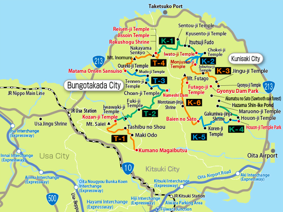
The Kunisaki peninsula is located the in northeast order of Kyushu island in Japan. The peninsula is made up of Mt. Futago in the center, with many forests and valleys stemming from its summit.
Futago-san is the location of historic mountain worshiping rituals in both the Shinto and Buddhist religions, called “Rokugo Manzan”. The many shrines and temples dotted on all sides of the mountain are linked by a centuries-old multi-day hike, which was historically used for religious worship purposes.
The trail can be broken down into 10 sections, each 11-18 km long.
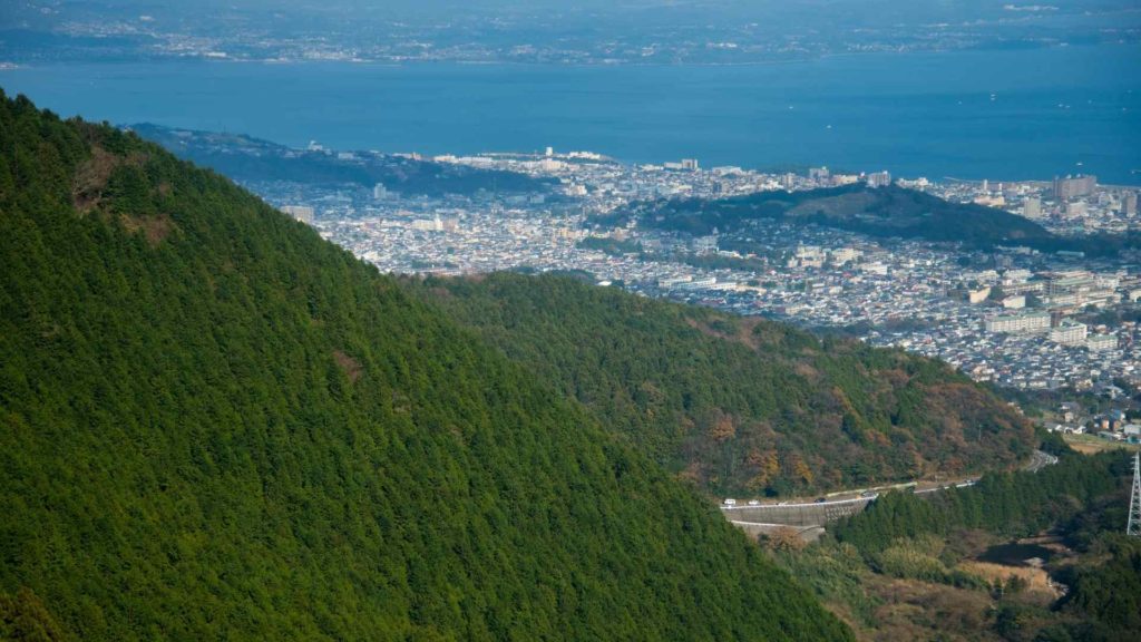
This long distance hike starts in Kumano Magaibutsu, a famous landmark consisting of carved stone Buddha statues set into the mountainside.
The trail circles the summit of the mountain over 10 days and stops by locations such as Kozan-ji temple, Fuki-ji temple, Matama Onsen Sansuiso, and Iwato-ji temple.
The last leg of the trail starts at Baien no Sato park and ends at Futago-ji Temple at the summit of Mt. Futago. Details about each leg of the hike including distance and key landmarks can be found on this website.
Here are some other things to know about the Kunisaki Peninsula mountain-worshipping Trail:
- Duration: 10 days
- Distance: ~135 km
- Accommodation: A few guesthouses, ryokan, hotels. Best to book in advance
- Food: Available at guesthouses, some convenience stores, restaurants and cafes in towns along the trail
- Location: Kyushu
- Closest large city: Oita, Beppu
- Other things to know: This area of Kyushu is known for its onsen. Be sure to spend some time relaxing in these hot springs after you finish this multi-day hike in Japan!
13. Shin-etsu trail in Nagano
The Shin-etsu trail is said to be another another historic highway of Japan that only recently rebranded to become a multi-day hike destination for tourists.
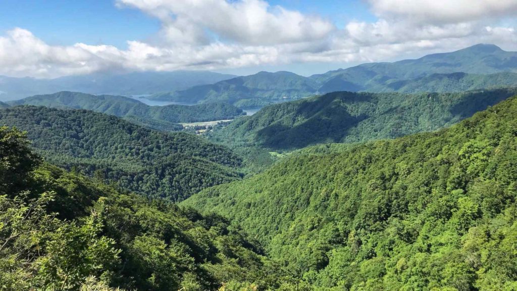
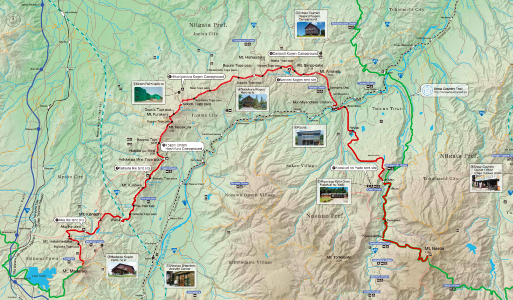
The trail starts at Mt Madarao, near a popular tourism village and ends at Mt. Naeba, and spans the ridge of the Sekida mountain range. This hike requires tents and some navigation skill as it is less established.
A map of the trail lists where to stay along the trail, most of which require camping equipment. One hiker mentions that the campsites are often not conveniently located near the trail.
Although accommodation options such as hotels are listed, they are a short drive away from the actual trail so hikers will need to arrange pick-ups and transfers separately for each day.
Here’s some additional information about the multi-day Shin-estu Trail in Nagano, Japan:
- Duration: 5-6 days
- Distance: 65 km
- Accommodation: Mostly camping, guesthouses if transport is arranged
- Food: Provided at guesthouses or cooking at campsites
- Location: Nagano prefecture
- Closest large city: Nagano
Where to find more Multi-Day Hikes in Japan
Check out some of my other multi-day, village-to-village hikes on my trekking page. My favorites include:
- Annapurna Circuit and Everest Base Camp in Nepal
- Mestia to Ushguli in Georgia
- Kalaw to Inle Lake in Myanmar
- Four Day Circuit Trek in the Swiss Alps
Read about some of my favorite day-hikes in Japan too:
- Mt. Fuji (bullet hike)
- Mt. Jinba to Mt. Takao near Tokyo
- Mt. Misen in Miyajima
Pin these multi-day hikes in Japan for later!


Are You Prepared For Your Trip To Japan?
Be sure to check out my Japan home page for Japan travel information, insider tips, reading list, and must-haves for traveling to Japan!
- Book Your Flights – To find the cheapest flights, flexibility is key. I use both Google Flights for their low fare calendar, and Skiplagged, which uses airfare loopholes to get the lowest prices. For a trip to Japan, check flights to both Tokyo airports (Haneda, Narita) and to Osaka (Kansai).
- Getting Around Japan: Prepare your JR Pass and Suica transit card before you depart.
- Book Your Accommodation – Check out Booking.com for the largest selection of accommodation in Japan. Consider having a bit of fun at one of these Weirdest Hotels in Japan too 🙂
- Book Local Excursions – Don’t miss out on world-class experiences, like Teamlab Borderless or Tokyo Disneyland, by booking tickets online now. Check GetYourGuide and Klook for fun experiences all around Japan.
- Stay Connected: Order a pocket WiFi for airport pickup if you’re traveling with family or with a large group. Solo traveling to Japan? Order a SIM card just for you.
- Pack Your Essentials – Check out my posts about Long Term Travel Gear, and Carry-On Luggage Packing Essentials.
- Read more on my Travel Resources page!




2 thoughts on “13 Best Multi-Day Hikes in Japan”
I am in love with this article!!! My family has done a lot of hiking and have recently decided to jump into multi-day hikes. I’ve been researching trails all over the world and making a list. Really, this is one of the best articles I’ve found about multi-day hikes in Japan. You’ve given me everything I need. I love the idea of doing a pilgrimage hike – it’s so cool to thing of how many people and for how many years people have been walking those paths. I pinned it so I can come back to it later when we plan our trip to Japan.
Amaaazing post! I would love love looove to do more multi day hikes in Japan. I have only completed Mt Fuji and a 5 day incredible hike from Kamikochi (Mout Yari was probably the most amazing place I have ever camped…)
I loved in Nara for a few years so the Kumano trail is calling to me too. I really should have done it year ago!