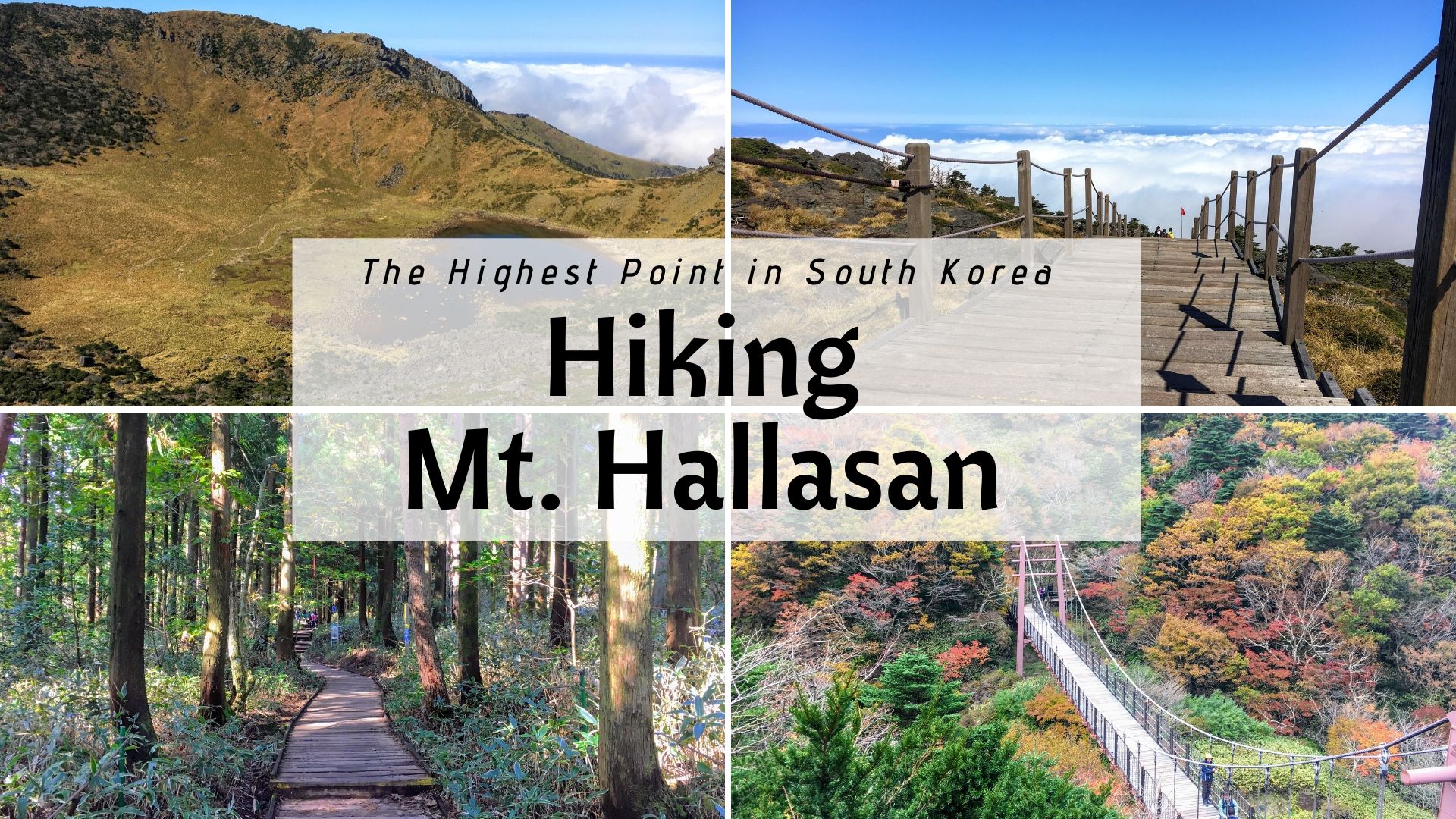
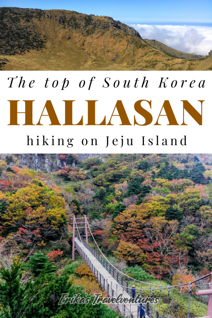
Hallasan Mountain is the highest point in South Korea, and hiking to the summit was one of my highlights of visiting Jeju Island. Hallasan’s volcanic activity millions of years ago is what created Jeju Island, but today, it stands tall and dormant at the heart of the island. Today, the mountain is the center of a national park, and the entire area is recognized as a UNESCO World Natural Heritage Site.
Five hiking trails go up Mt. Hallasan to the upper crater, but only two trails reach the very summit – the top of South Korea. I chose to hike a combination of those two summit trails, and below, I’ve shared exactly why that route is the best trail to hike Hallasan (along with tips from my experience). If you’re up for the challenge, this is one hike you won’t forget!
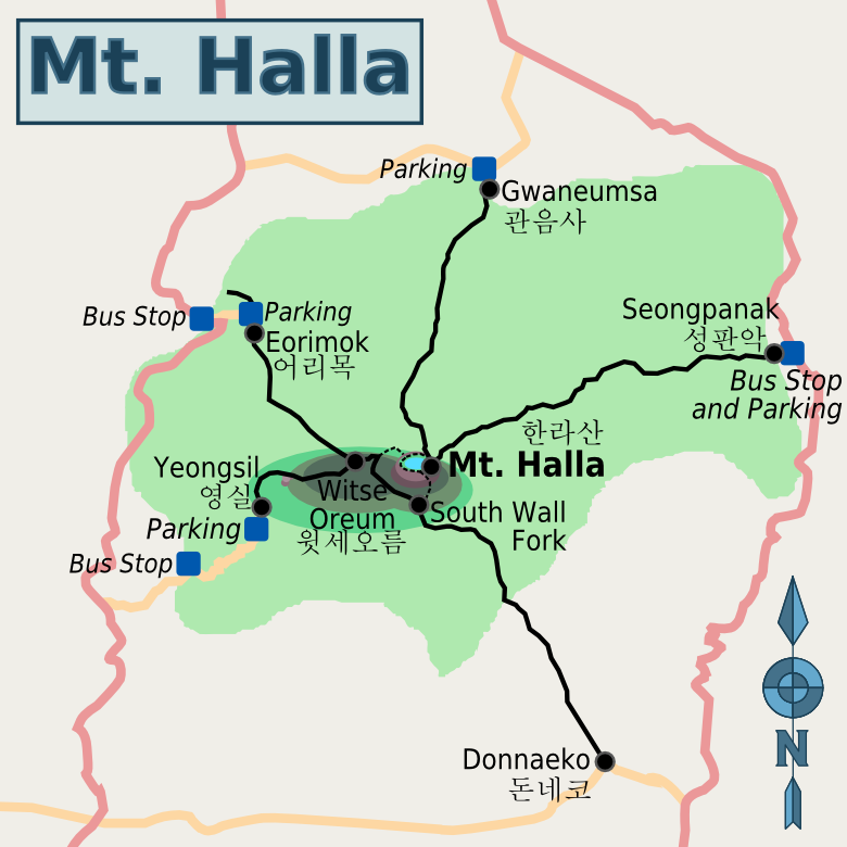
Four Main Hallasan Hiking Trails
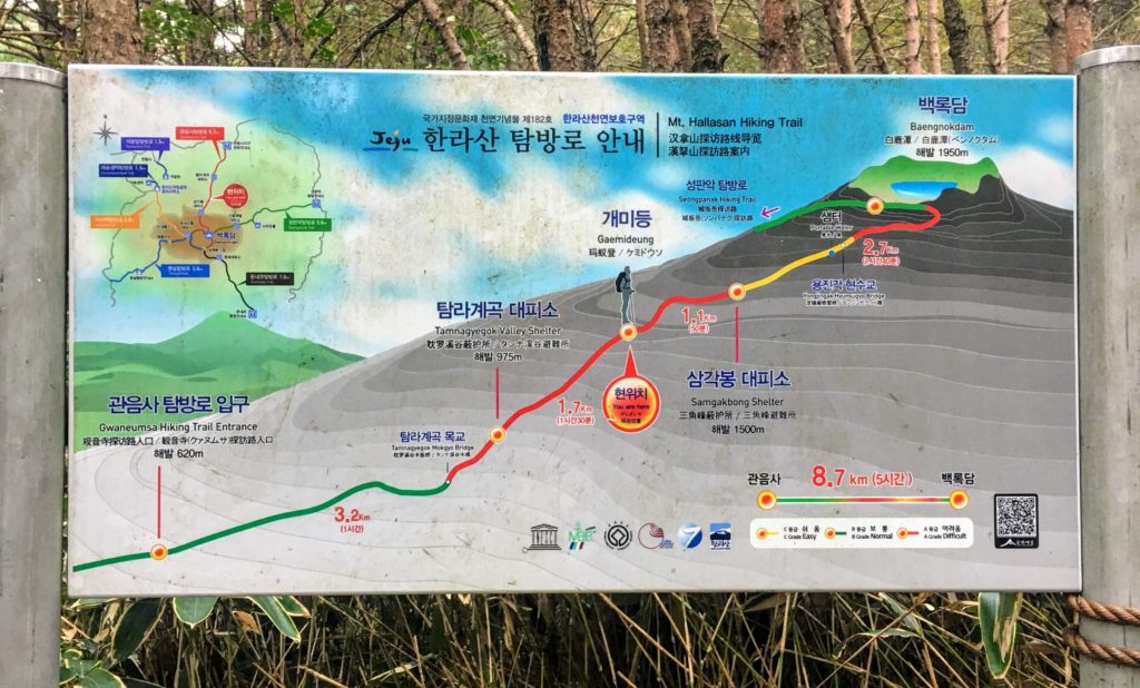
If you look at a map of Hallasan National Park, there are five Hallasan hiking trails that run up to its crater. You’ll see that only two of these trails actually reach the summit.
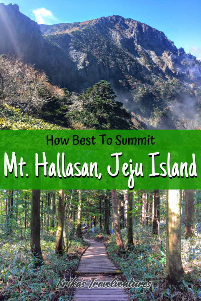
The Seongpanak Trail is the best Hallasan hiking trail to go up for most hikers. It’s the longest Hallasan hiking trail at 9.7km, but I found that it starts gradual, with only a short stretch of incline and stairs. The steepest part of the Seongpanak trail is near the summit, where you just have to take many flights of wooden stairs. From my experience overall, it was not too bad if you take it slow!
The best Hallasan hiking trail to take down from the summit is the Gwaneumsa Trail. The Gwaneumsa Trail connects to Seongpanak Trail at Hallasan’s summit, so it’s easy to navigate hiking up Seongpanak and down Gwaneumsa Trail. This trail is 8.7km long, for a combined 18.4 km day of hiking Mt. Hallasan.
How long does this route take?
For me to hike Hallasan up the Seongpanak Trail took 3 hours, and down via the Gwaneumsa Trail took me 2.5 hours. Expect this exact Hallasan hike trail to take about 6-8 hours, including time for resting at the summit.
Because this takes basically a full day it climb, it’s important to start early in the morning like I did, so you’re able to return to town before it gets dark.
The Second Best Trail to Hike Hallasan?
Answer: Gwaneumsa Trail Up and Down
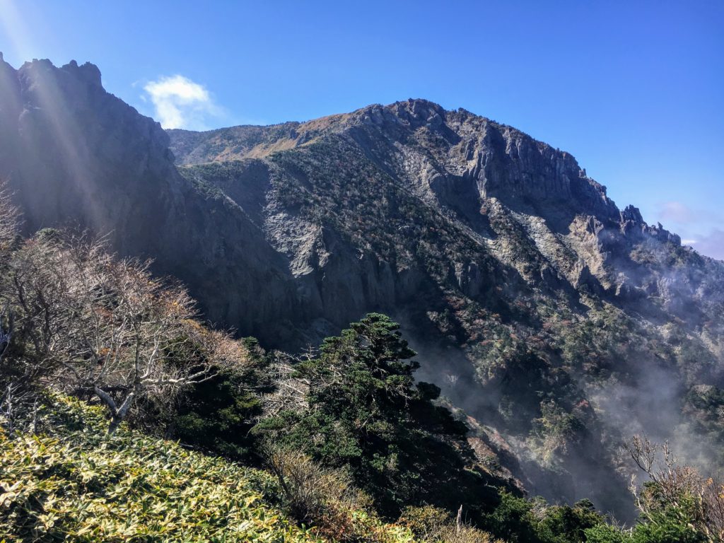
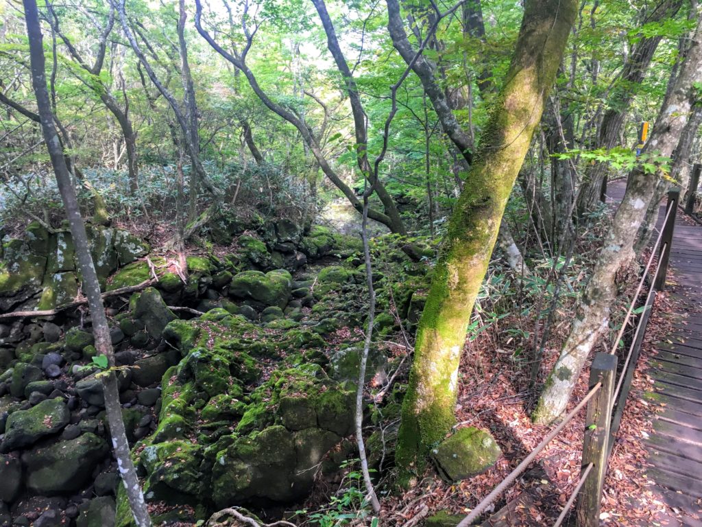
If you don’t mind hiking Hallsan via the same trail up and down, then I recommend taking the Gwaneumsa Trail up and down. The Gwaneumsa Trail is known as the most scenic out of the five options, and I also thought it was breathtaking! Walking over lava-rock rivers and down into ravines will remind you at every step that you are hiking Hallasan, a UNESCO Natural Heritage Site.
The only thing to note is the Gwaneumsa Trail is much more difficult to go up than the Seongpanak Trail because of how steep it is. So keep in mind, that going up and down the Gwaneumsa trail will take much more time. Expect an 8-9 hour day of hiking Hallasan if you decide to take the Gwaneumsa Trail up and down.
Note: If you’re staying South of Jeju Island, the popular Hallasan hiking trails are the Donnaeko Trail and the Yeongsil Trail. You can combine these two trails into one Hallasan hike, by going up the Donnaeko Trail and down the Yeongsil Trail. These two trails will just take hikers around the top crater of Mt. Hallasan though, and not to the summit of it.
I decided not to take this trail when hiking Hallasan, because my stubborn self really wanted to make it to the summit. I wanted to stand at the top of South Korea!
Gwaneumsa Trail in mid-October
Important Safety Things To Know Before Hiking Hallasan
When I visited Hallasan, there were very few places to stock up on water or food along the hiking trails. A number of buildings were under construction to provide more amenities in the future. To be safe, be sure to bring everything with you from Jeju city before you start hiking Hallasan.
I also found that the weather at Mt. Hallasan can change dramatically when at higher elevations. Be prepared for rain and cold, even in the heart of summer. Bring sunscreen to protect from the UV rays too. The Mt. Hallasan summit is above the tree line, so there is very little shade to hide from the sun.
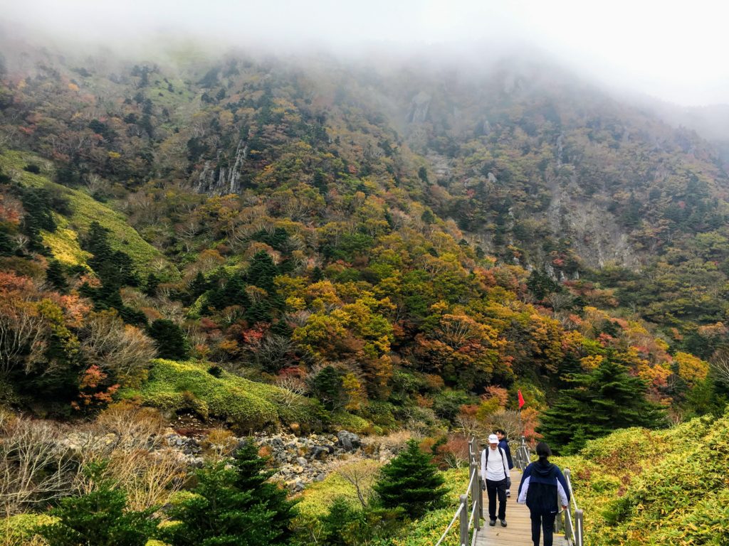
Another safety issue I found, was after a day of rain or when the clouds are thick on the mountain, many rocks are slippery, especially in the more densely forested areas. I recommend wearing hiking boots to help mitigate against falling or misstepping on the slippery lava rocks while hiking Hallasan.
Clouds coming in on the way down via the Gwaneumsa Trail
Hiking Hallasan Turnaround Times
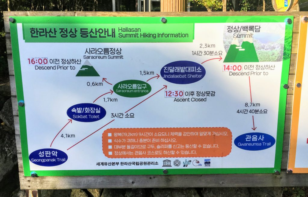
A strict turnaround time is in place for all Hallasan hiking trails. You cannot continue your Hallasan hike if you haven’t reached a designated mountain shelter before a certain time of the day (dependent on the time of the year).
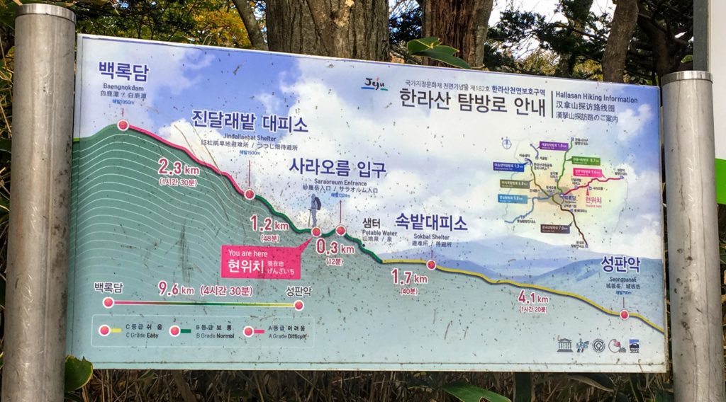
For the Seongpanak Trail, if you have not reached Jinailaebat Shelter by 1:00pm in the summer, 12:00pm in the winter, and 12:30pm in the fall, you’ll have to turn back without reaching the summit.
A strict descending time from the Mt. Hallasan summit is also in place. In the summer, start descending from the summit by 2:30pm. In the winter, by 1:30pm, and in the spring and fall, by 2:00pm.
Hiking Hallasan Packing List
Tip: In addition to packing regular drinks and snacks, being a reusable water bottle. There are some springs along the Seongpanak Trail where you can refill the bottle (but don’t rely on this solely for water, because they are easy to miss). Bring at least 1.5 liters of water per person.
Lunch and Snacks (you can’t buy anything on the Hallasan hiking trails)
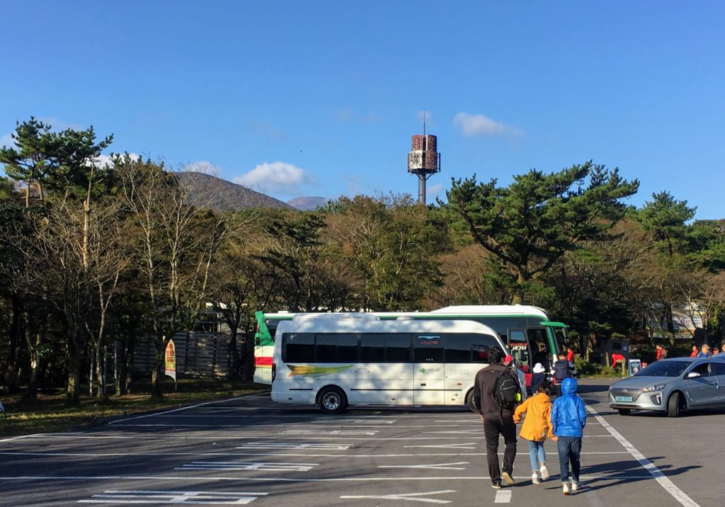
Starting Your Hallasan Hike: Getting to the Seongpanak Trail
From Jeju City Center, near Jeju City Hall, there are two direct busses that will take you to the Seongpanak Trailhead for the Hallasan hike: bus 181 is an express bus, and 281 is the local bus.
Before 8-8:30 in the morning, the time it takes for both of these busses to reach the trailhead station is about the same (just under 30 mins).
Tip: To navigate Jeju Island, check out the app Kakao Maps for near-accurate estimates on when busses will be arriving and departing.
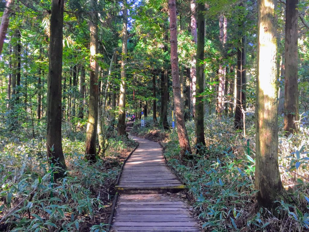
On the Seongpanak Trail: Hiking Hallasan
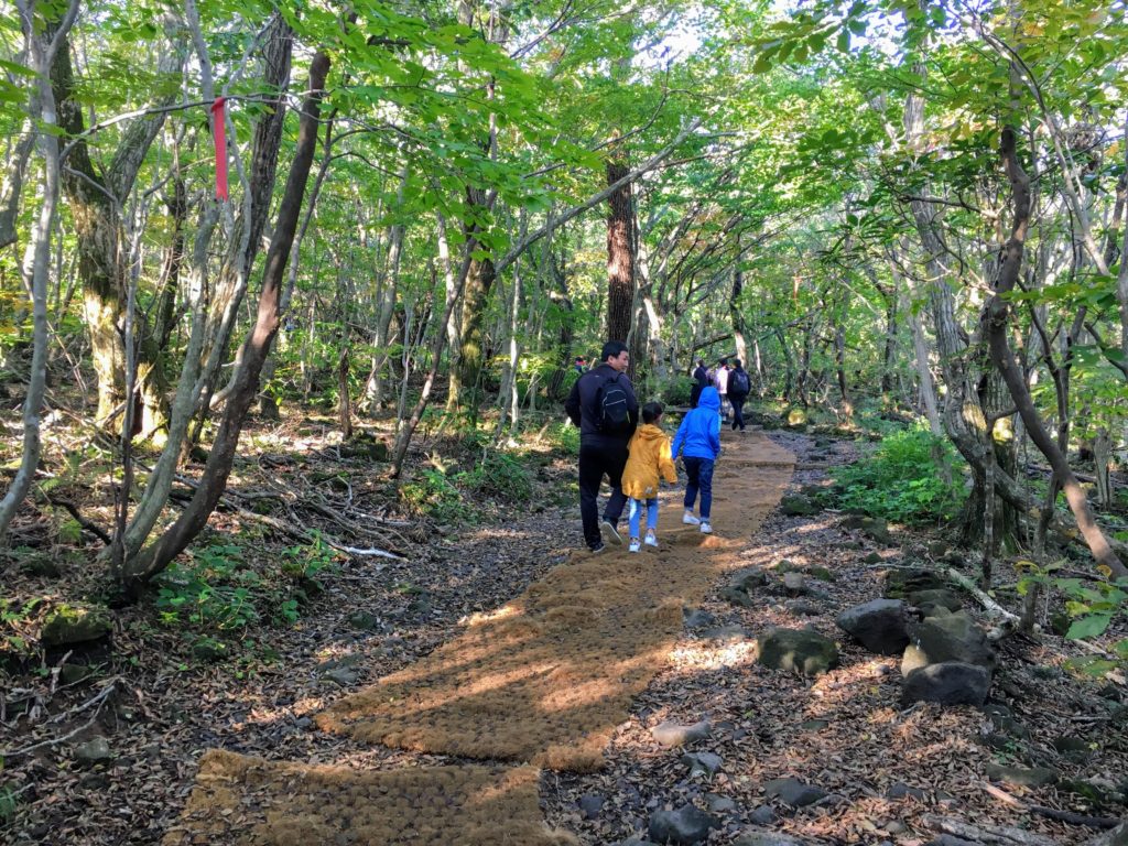
The reason why the Seongpanak Trail is the best Hallasan hiking trail is because it’s the easiest, both to hike and to navigate. Although a little endurance is necessary to make it up all 9.7km to the summit, most of the Seongpanak Trail is gentle slopes and wooden staircases.
There are two large shelters and rest areas, and there are several benches along the trail where you can break away for a rest too. Many locals, some with young children, brought picnic mats to lay out while they were having lunch or snacks along the Seongpanak trail.
Much of the start of the trail is covered in a rope-material carpet, which makes it easy to walk, compared to Gwaneumsa Trail’s slippery lava rocks.
Halfway Point: Seongpanak Trail Gets Steeper
Once the Seongpanak trail reaches the “normal” and “advanced” difficulty sections, it theoretically gets a bit steeper (see graphic below). There may be more staircases with fewer straightaways in between.
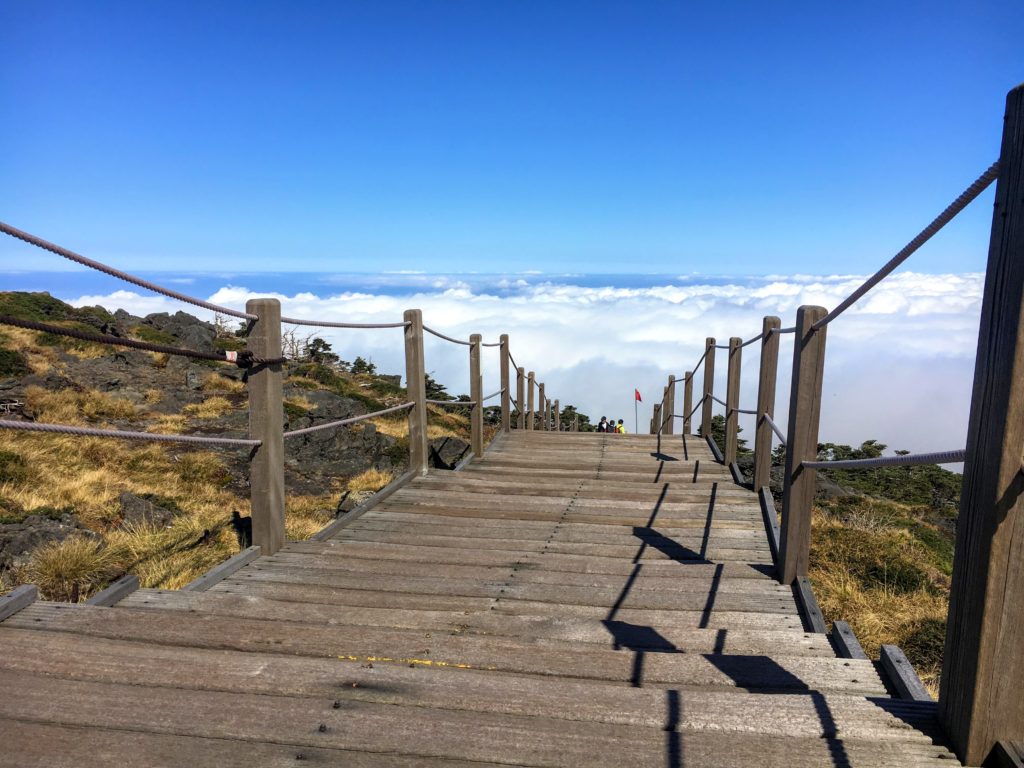
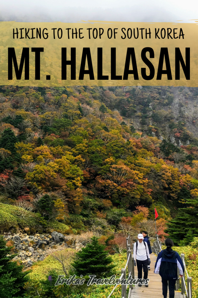
Near the end of the Seongpanak Trail, you reach a forest clearing where you’ll see a massive wooden staircase to the Hallasan summit. You’re basically at the top here!
Tip: I found that the view from the platforms along this staircase were some of the best of Jeju Island – better than the summit itself, so don’t shy away from taking breaks just before the top.
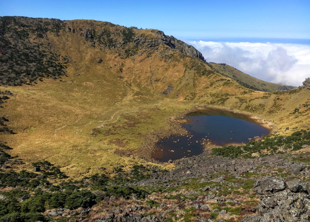
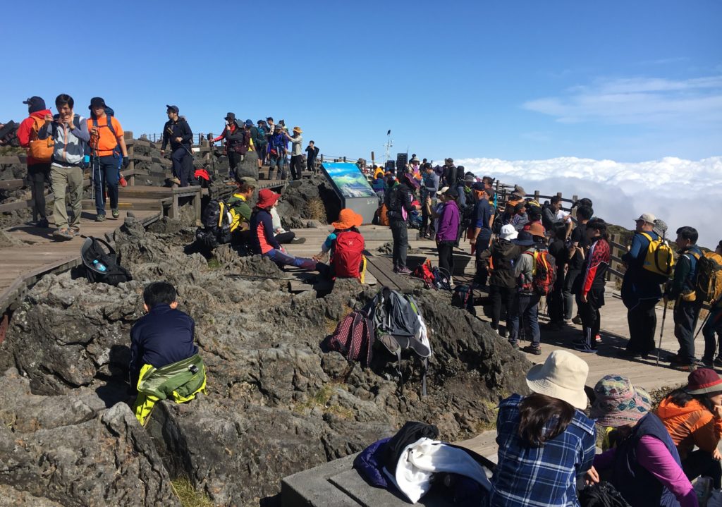
Mt. Hallasan Summit
The summit of Mt. Hallasan is mostly covered in wooden walkways. A commemorative rock lets you know that you’ve reached Hallasan’s summit, which you’ll have to wait a loooong time in line to take a picture with.
Peek down into the volcano’s crater, a grassy area off-limits to hikers. A beautiful lake sits in the middle, which changes colors and shapes depending on the season.
Right at the end of the Seongpanak trail, at the beginning of the summit platform, is where the crowds like to picnic. There are some walkways a little further down, towards the start of the Gwaneumsa Trail, where I was able to find some peace and quiet.
Hiking Down the Gwaneumsa Trail
The 8.7km Gwaneumsa Trail is mostly downhill without straightaways, and much of it is over rocky stairs. I had a little bit of a struggle due to knee pain – it’s a brutal down-hill! One of the most difficult sections for me was close to the summit, which has ropes to hold on to as you go down large stone steps.
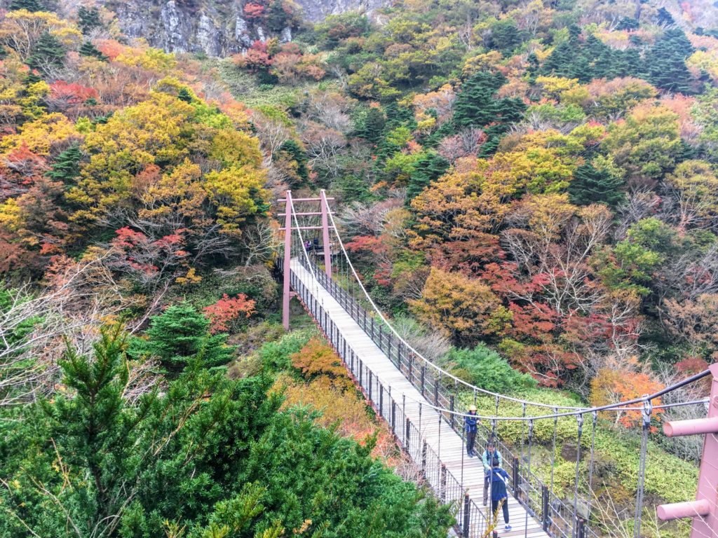
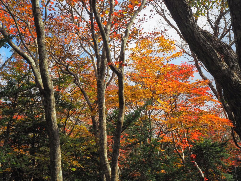
Luckily the view on the Gwaneumsa Trail is amazing, starting with the razor-sharp cliffs that jut out from Hallasan’s summit, to suspension bridges over deep ravines. Especially in the autumn season, the fall foliage is bright red and yellow.
Tips for descending to make it easier on your knees: quicken your pace when you’re going down stairs so your knees don’t feel the full impact of each step. Take frequent breaks. Move down larger steps sideways and alternate sides.
Getting back to Jeju City from Gwaneumsa Trail
Bus 475 runs regularly from the road next to the Gwaneumsa Trail head. Take this bus to Jeju National University Station, a transit hub, then transfer to any of the other busses heading to Jeju City Center (212, 222, 232, 341, 342, 351, 352, and more).
My final thoughts: It’s not every day that you get to spend time at the highest point in the whole country. Hallasan on Jeju Island is a special occasion when you can do just that. The feeling of accomplishment after summiting Hallasan is well worth the sore legs and feet afterwards.
Book Your Flights – To find the cheapest flights, flexibility is key. I use both Google Flights for their low fare calendar, and Skiplagged, which uses airfare loopholes to get the lowest prices. For a trip to South Korea, check flights to Seoul, Jeju Island, and Busan.
Book Your Accommodation – Check out Booking.com for the largest selection of accommodation in South Korea.
Book Local Excursions – Don’t miss out on one-of-a-kind experiences, like the full-day DMZ tour, by booking tickets online now. Check GetYourGuide and Klook for fun experiences all around South Korea.
Stay Connected: Order a pocket WiFi for airport pickup if you’re traveling with family or with a large group. Solo traveling to South Korea? Order a SIM card just for you.